
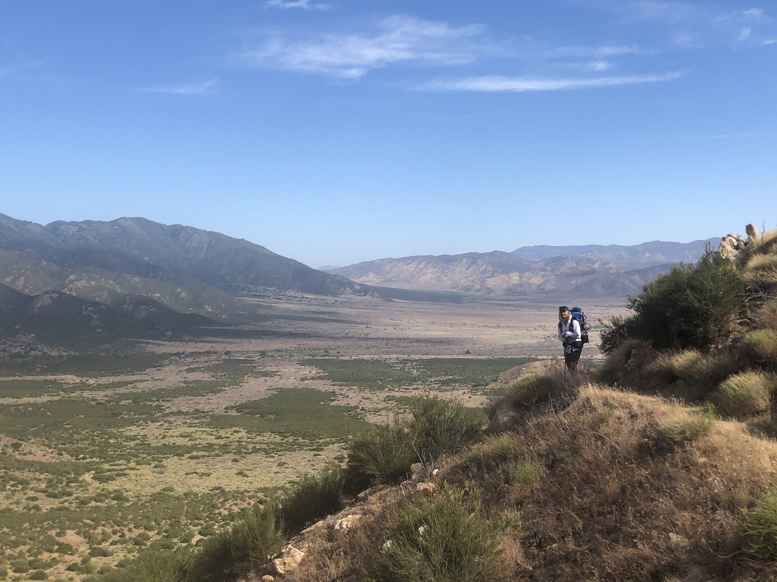
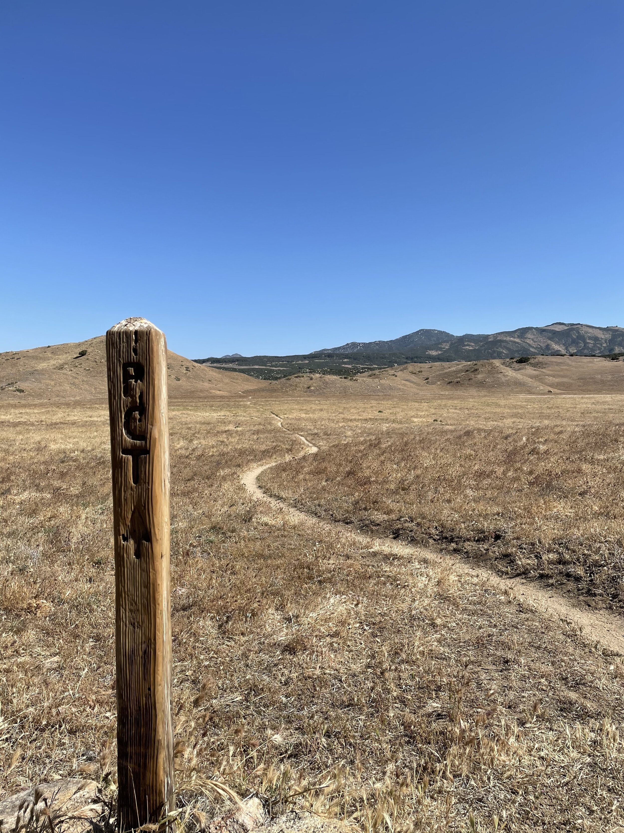
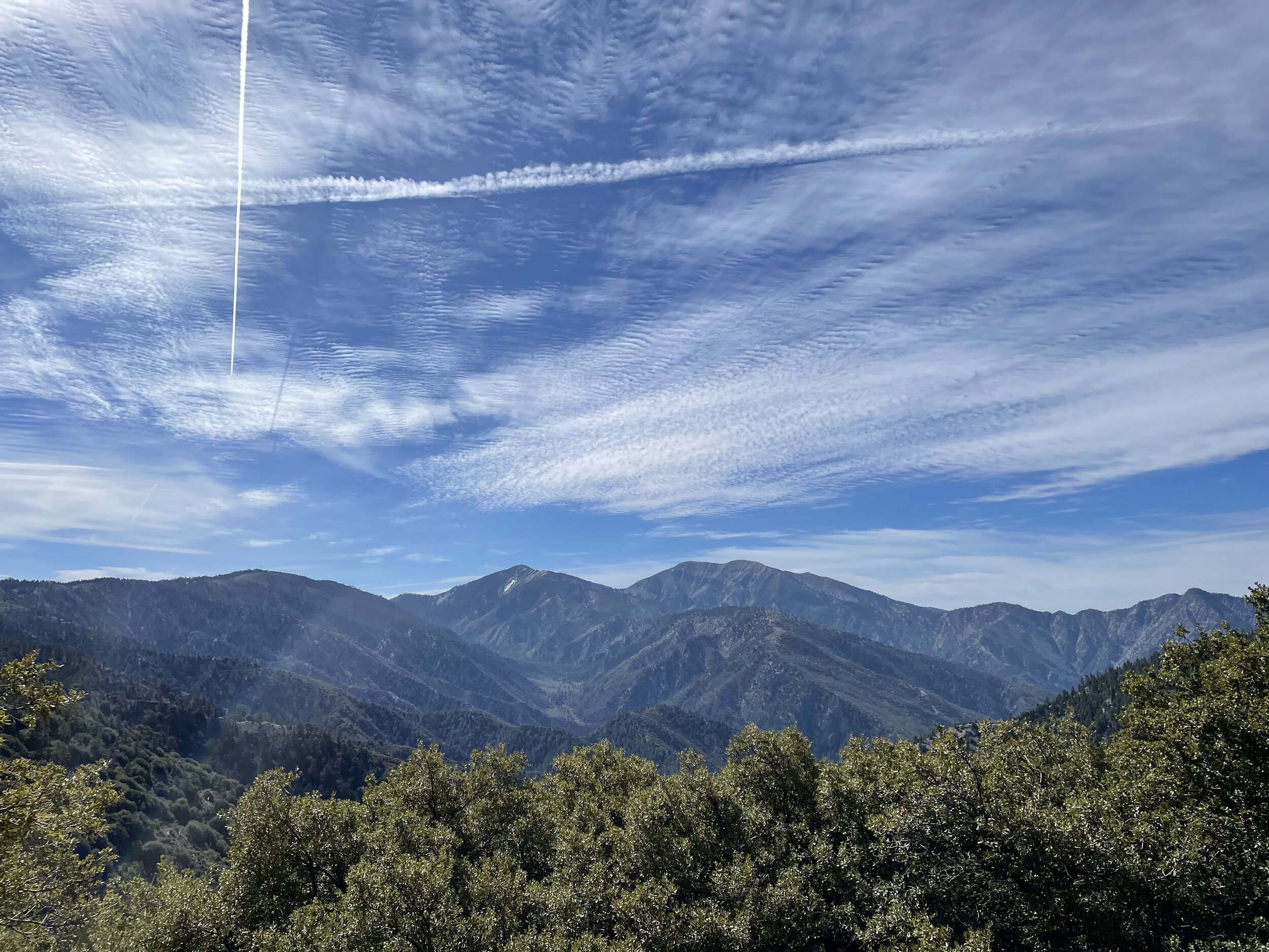
THE DESERT
The Desert section of the Pacific Crest trail stretches from Campo California, on the border with Mexico, to Kennedy Meadows at mile 702. The trail winds up and over some of the tallest mountains in southern California, along the floor of the Mojave desert, and through the high desert hills.
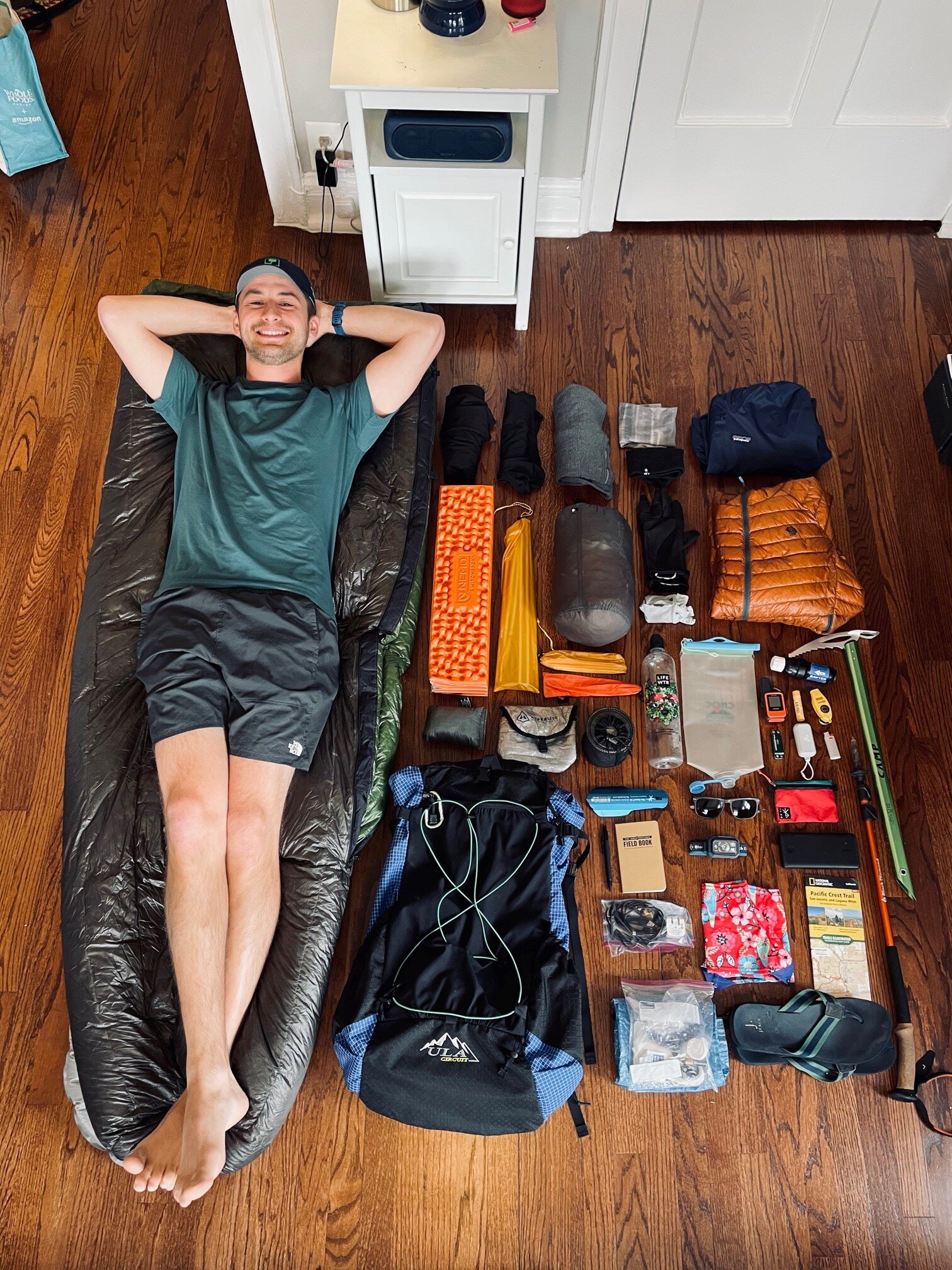
Everything I thought I would need for 5 months in the wilderness
Day 0. Chicago - San Diego
“A journey of a thousand miles starts with a single airport beer”
Lots of hikers would tell you that one of the most stressful days of thru hiking the PCT is the day before your start date. Campo isn’t really close to anything and public transport options are limited. I was lucky to have my buddy, Zach, in San Diego who let me crash at his place the night before and then drive me out first thing in the morning. Most other hikers relied on trail angels to get a ride from San Diego or just eat the cost of an Uber from the airport all the way to the border. I flew in from my hometown of Chicago, got some dinner with Zach, and stayed up later than we should have talking gear and strategy for my first few days on trail.

PCT Desert Video
In addition to the blog below, I have made a day by day video series showing what life was like on the PCT. please subscribe to our YouTube channel to see the rest of the series!
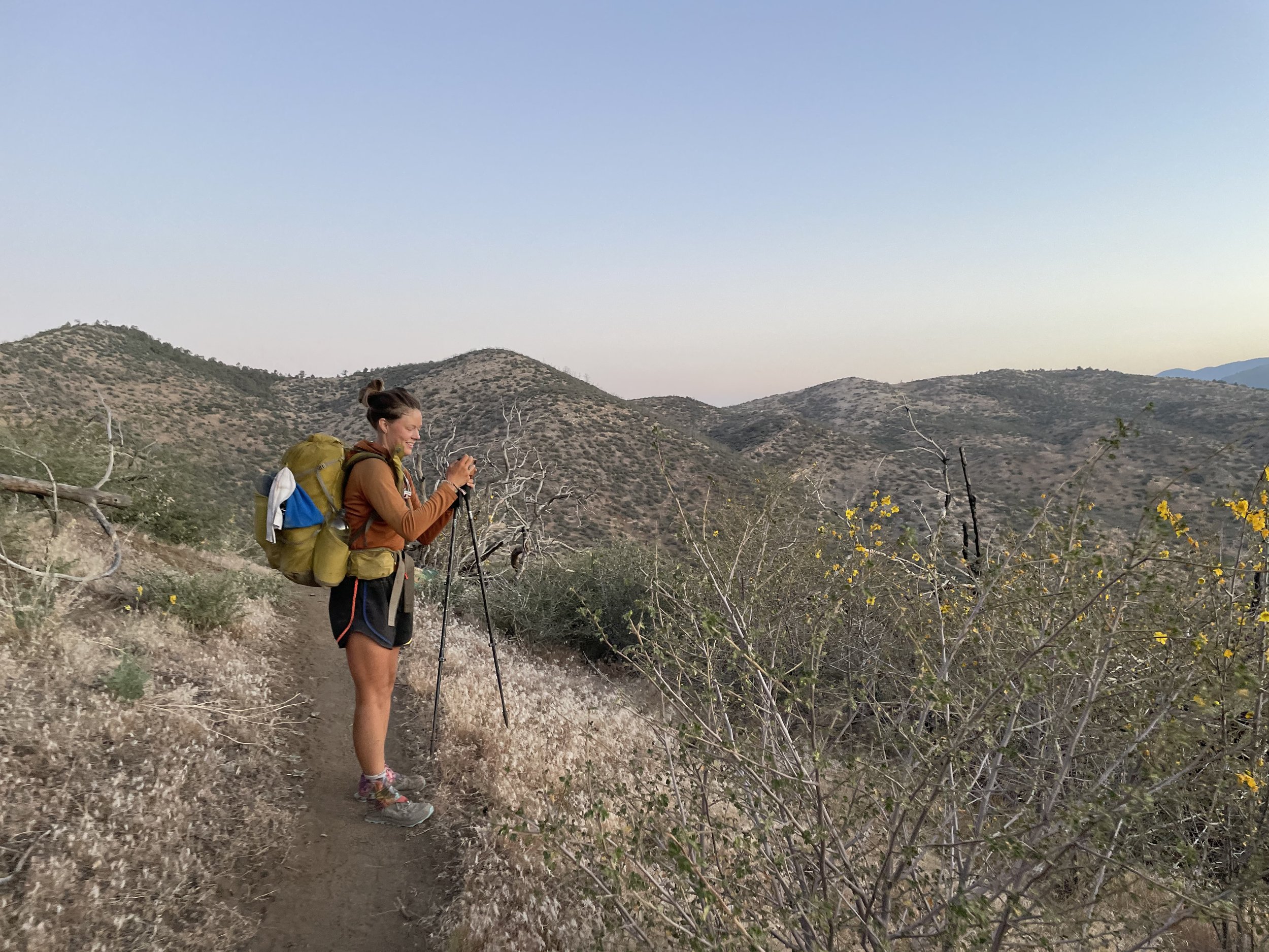
Day 1 Miles 0 - 20 20 Hiked
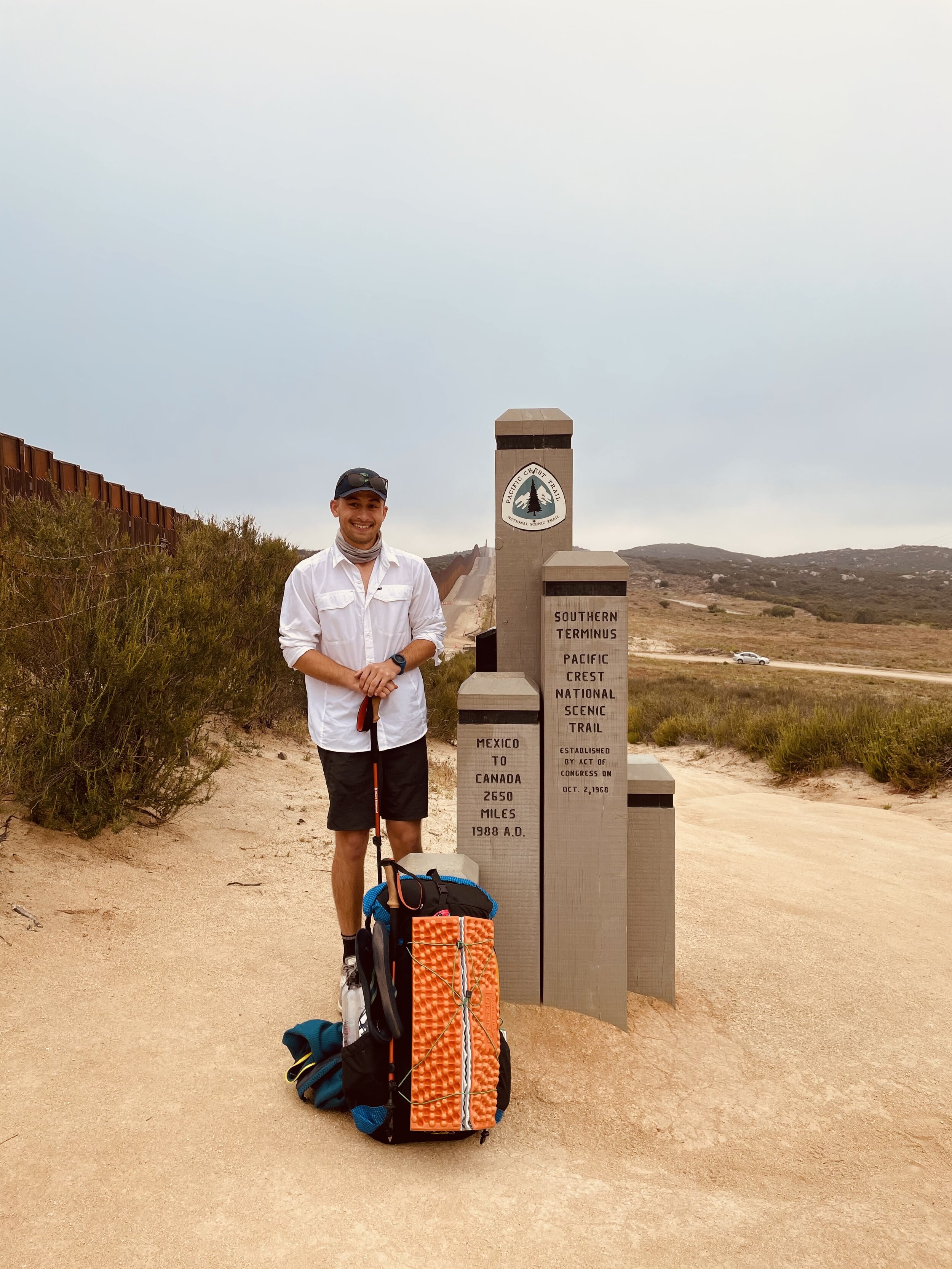
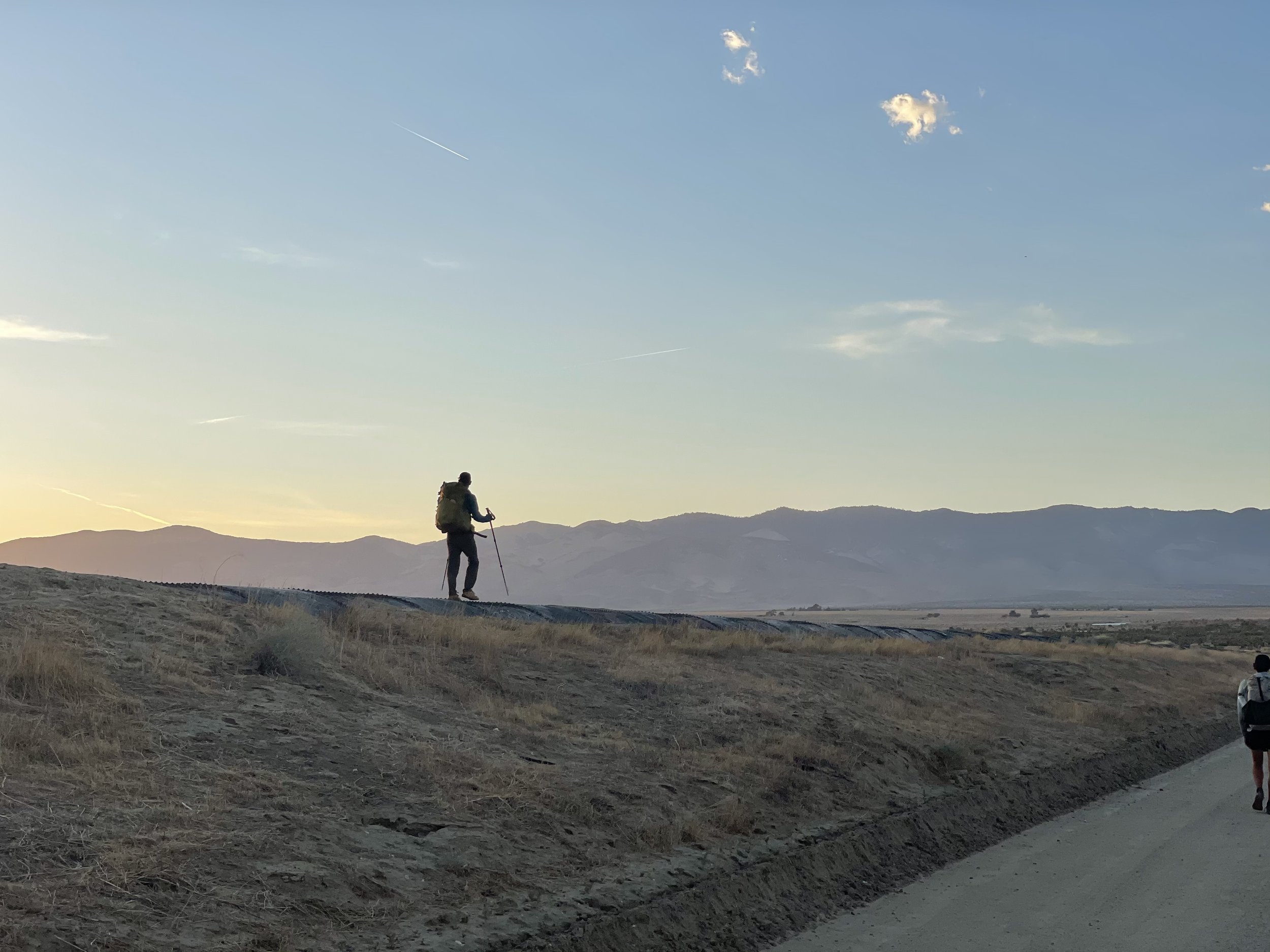
Zach and I got up early and hit a Starbucks on our way out of San Diego. I was nervous. The thought of getting injured early or failing to make it at least a month stuck with me the whole ride to the border. It was a cloudy and foggy morning with the sun breaking through every now and again. Zach drove us right up to the large metal wall and we walked the rest of the way to the monument that we had both seen so many times before in books and videos and even in person for Zach. We took some pictures, I gave my friend a hug, and I started walking north.
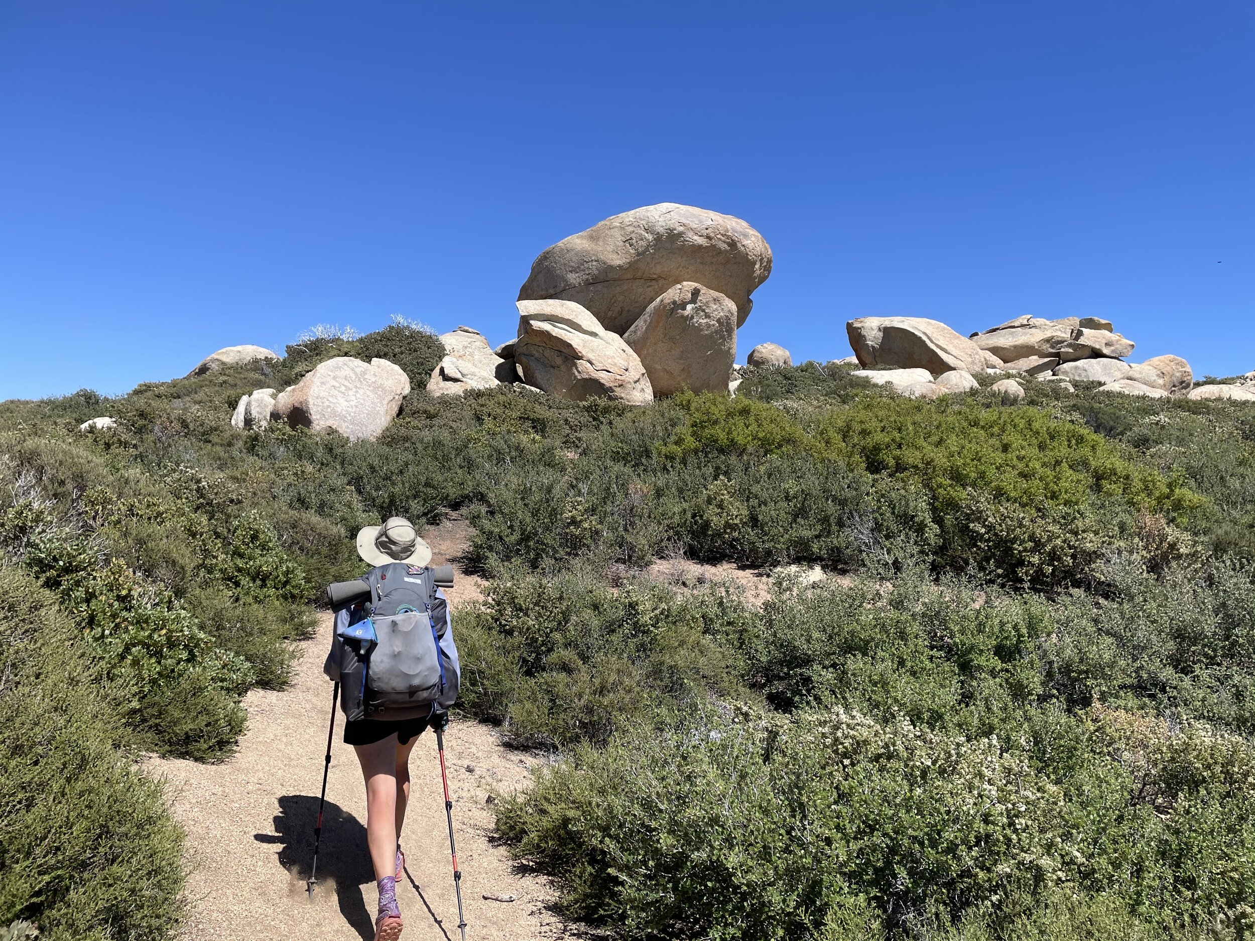
Almost all thru hikers use an app called Guthook as a primary navigation tool. It has downloadable maps with icons for water sources, campsites, towns, and lots of other helpful stuff. It uses your phones GPS so it can tell you how far away you are from a given spot on the trail even when you don’t have signal. The first water source on the trail is 4.4 miles in. A little stream that the trail hops over on a series of rocks. I was hoping to make it into Lake Morena (mile 20) for Dinner that night and, in my hurry to fill up my water bladder, I lost my footing and fell ass backwards into the FIRST piece of water that the trail crosses.
With a new sense of caution I pushed on, had lunch at about the 10 mile mark for the day, and finally caught up to a person! Keith didn’t have a trail name either and he was happy to do most of the talking for another 6 miles or so down into Hauser creek at mile 15. A lot of hikers call it a day at Hauser but I had ambitions of a beer and a burger so I pushed on up the hill with a girl named “Street Kale” from Alaska. Kale, for short, had hiked half of the Te Aroroa in New Zealand and seemed to be completely in her element pointing out the different flowers and powering up and out of Hauser Creek Canyon in her Chaco sandals.
Kale and I rolled into Lake Morena together around 5. She decided to push on while I opted to pitch my tent in the campground and hit the malt shop for some beers and burgers. Keith was there with another hiker named Medicine Man. Returning to the campground, I found lots of other hikers had rolled in and were camping here as well. We had a small campfire and got to know each other before turning in around 9 pm.
I was sore as hell and my feet already hurt but this was all overshadowed by how stoked I was to be out there.
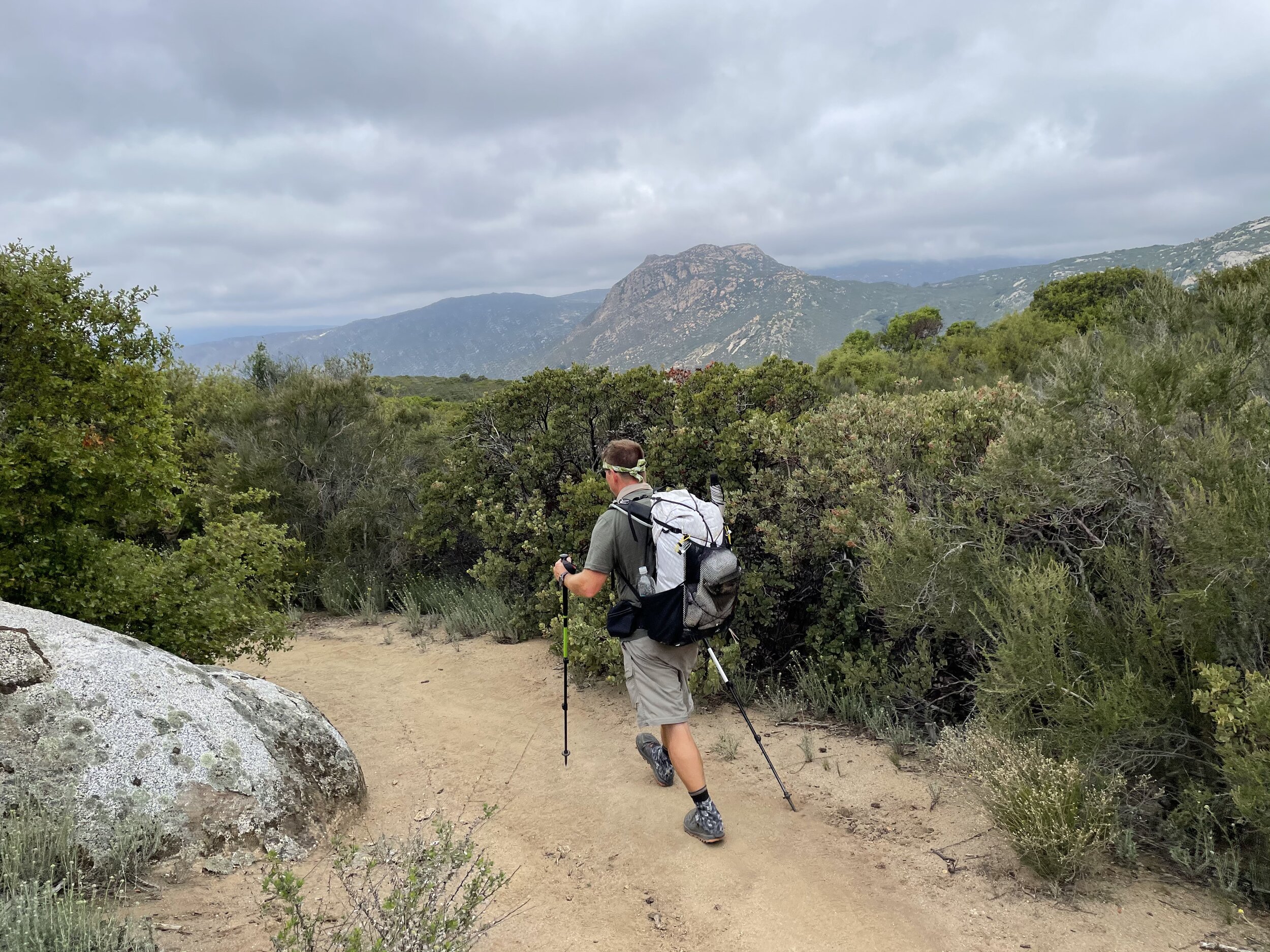
Keith, later to be named “Bartender” leading the way

Day 2 Miles 20- 42 22 Hiked
My alarm went off at 5:30 and it was a top tier “Where the f am I” moment. I gathered myself, clumsily packed down camp in the morning fog, and started walking down the wrong trail.
After correcting myself I facetimed my family and told them all about Day 1. My younger sister is kindergarten teacher and the whole class was thrilled to see the surroundings and watch a rabbit sprint down the trail. I caught Keith after a few miles and hiked with him to a water source about 10 miles in where Kale was already having some lunch. We pushed on around noon and caught up to “Strings” and “Traps” who had also started the day before and had rolled into camp after I was fast asleep.
Our little group pushed on through a hot, cloudless afternoon to Mt Laguna campground where we were informed that the store was already closed but there were beers and hotdogs from other hikers for anyone that might want some. I met my Instagram buddy Chris Jones at this little party. He had just gotten his trail name “Captain fantastic” and it was great to catch up with him in person.

Traps and Bartender take in the view
Day 3 Miles 42 - 62.5 20.5 Hiked
We packed down our tents and rolled out of the campground as a little group while other hikers were getting up and organized. I had sent a resupply package to the general store so I headed into town to wait for them to open while Traps, Bartender, and Strings pushed on up the trail.
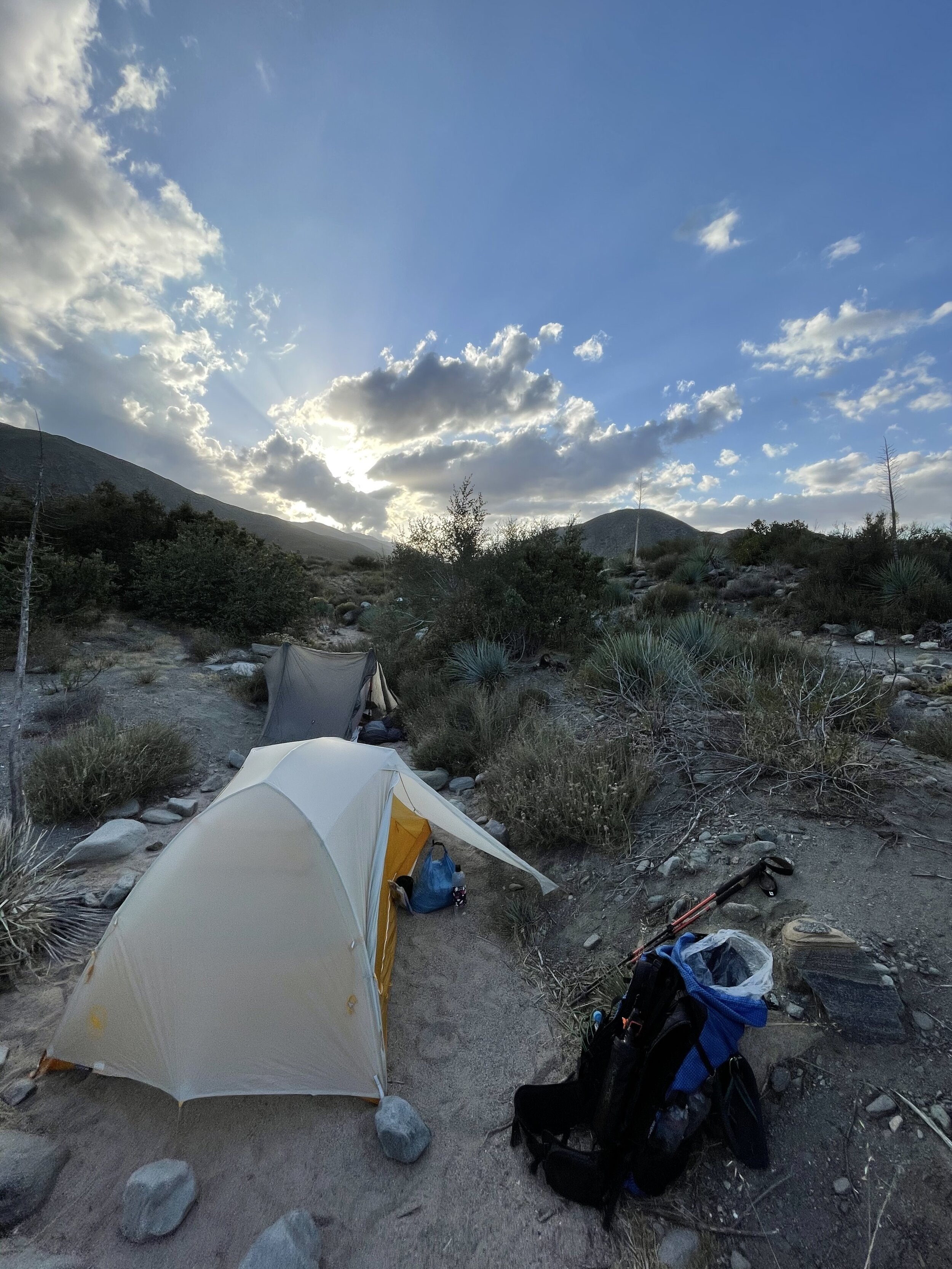
After getting my package and moving its contents into my pack, I enjoyed some solo hiking and incredible views. I caught up to the group around lunch and Traps, Bartender, and I walked together for most of the rest of the day. We picked up some water from the Sunrise trailhead and pushed on another few miles to cowboy camp (sleeping under the stars, no tent) in a little clearing in the sage bushes just off to the side of the trail.
The heat on this day was a reminder of our late start dates. Ginger Pony, an absolute character of a hiker, was on the verge of heat stroke and a small group hitched straight into Julian from the trailhead with him. We filled up as much water as we could carry from the trailhead before camping with nowhere to fill up again until we hit the town of Julian the following day.
Day 4 Miles 62.5 - 77 14.5 Hiked
My first night ever of sleeping under the stars was incredible. I felt completely safe from the elements and wildlife around these strangers and woke several times to see the clearest milky way of my life. The other benefit of cowboy camping was the quick pack up in the morning.
We all got moving early but we could tell it was going to be hot. I ran out of water way faster than I would care to admit but Traps saved me by generously sharing some of their water as we wove through the desert hills. This would become a theme of the desert section.
We struggled the 14.5 miles into Scissors crossing, a little overpass on the desert floor. Under the bridge we met a hiker named Fireball who seemed to be enjoying a nice nap under the brim of her baseball hat.
We got a ride with a trail angel, Rangel, into town for a quick resupply and consultation on our blisters with Mary from Two Foot Adventures, a local outfitter, and then to an RV park where we grabbed showers and Bartender got us a small cabin with AC for the night.

chased under a rock by the early afternoon sun
Day 5 Miles 77 - 94.4 17.4 Hiked
We woke up early at he RV park cabin and inhaled some breakfast pizza before getting a ride back to the trail with Rangel. We absolutely manhandled some switchbacks after a good nights sleep and watched as fighter jets swung around the mountain ridges below us. we wondered if they could see us against the mountain and knew what we were doing.
We caught up to some familiar faces like Captain Fantastic and Ginger pony and played leapfrog into the 3rd Gate Water Cache. This is a bank of hundreds of 3 gallon water bottles maintained by volunteers. If it weren’t for this cache it would be a nearly 40 mile dry stretch and almost impossible to complete unsupported in the hot summer months.
We hung out in the shade of a Sage bush for 4.5 hours until it started to cool off enough to walk.
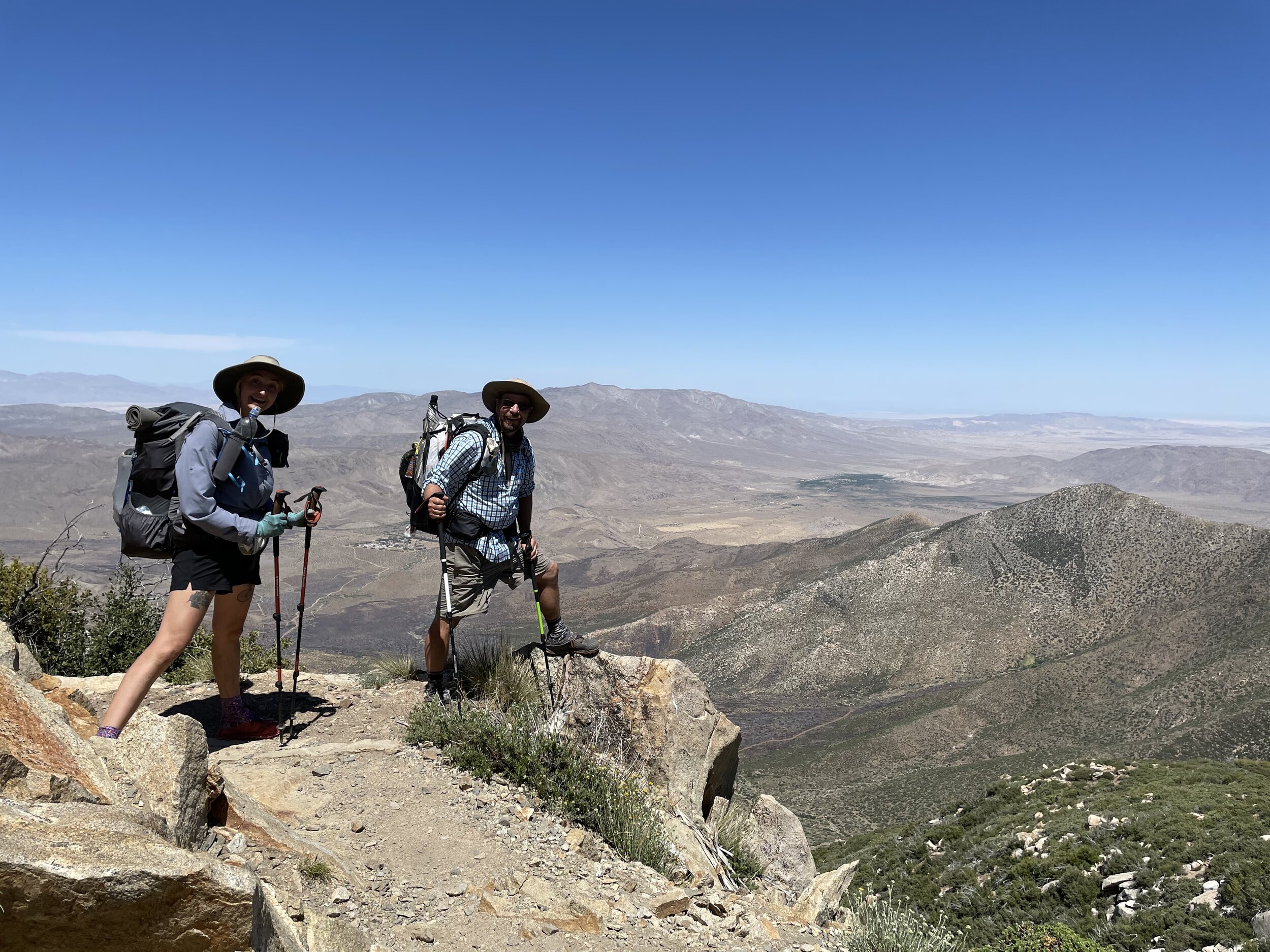
We hiked with Captain fantastic up to a ridge overlooking the valley below. Here we met Hopscotch and Lighthouse, two friends from Michigan. Hopscotch had gotten her trail name from jumping over what she thought was a dead Rattlesnake but Lighthouse would get hers this night.
Most of us opted to cowboy camp since it was windy on the ridge and a billowing tent makes a lot more noise than one would think. I woke at 3 am to look over and see a panicked lighthouse packing down her tent and scrambling to collect pieces of gear that were trying to sail away. she had her headlamp on full power and was swiveling her head back and forth trying to shepherd her gear back into her pack. through the dust she looked just like a lighthouse in a storm. We joked about it the next morning and gave her the name.


Day 6 Miles 94.4 - 112.5 18.1 Hiked
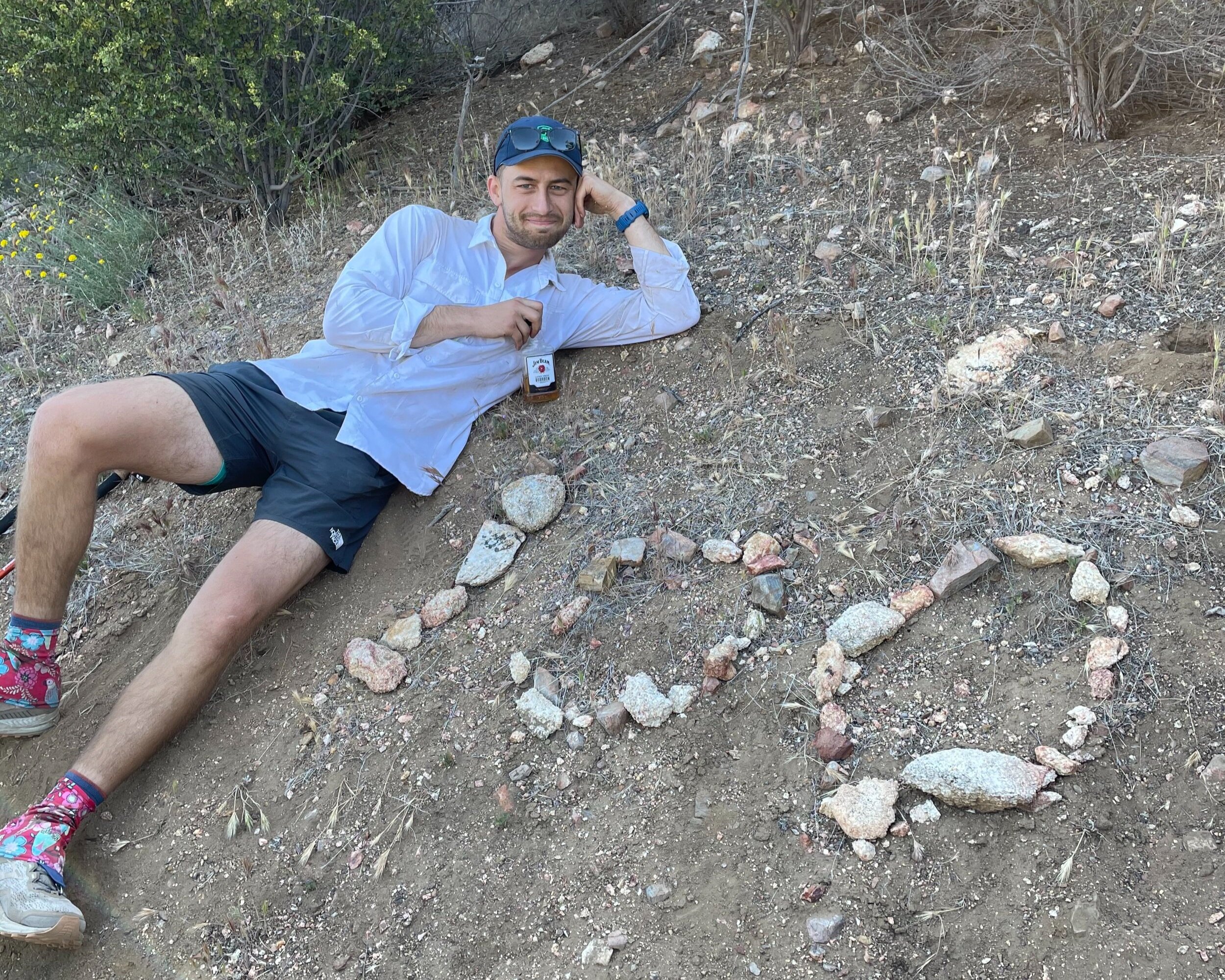
Traps, Bartender and I cooked it out of camp. we were stoked to be hitting the 100 mile marker in the morning and we made it there with no trouble. We celebrated with some Jim Beam and the first of many photoshoots at a marked 100 mile interval. In time, we would start walking past these markers without even taking a picture but this first one felt special. I did’’t feel like as much of an imposter anymore.
We continued on to a meadow where we progressed towards Eagle Rock which was just as cool as we thought it would be. A few more miles took us to the road into Warner Springs where we collected some packages from the post office and loitered in a gas station parking lot until it was time to ferry our beers to a campsite just a few more miles down the trail. There was a big group at camp and we enjoyed our Coors lights and each others company before turning in.
“I need a hundred black coffins for a hundred bad men” - Rick Ross

Eagle Rock

Hiker parking at Mike’s Place

Mike parking at Mike’s place
Day 7 Miles 112.5 - 131.5 19 Hiked
There were a lot of people at camp and everyone was moving fairly early which was always motivating. Traps and I hiked together most of the day and we made it to “Mikes Place” to re-up on water and wait out the heat.
Mikes place is tough to describe. It has a history of treating female hikers poorly and is just some guys place in the middle of the desert. There were definitely some characters there but the afternoon was largely incident free.
Hanging out for a few hours in the shade gave us a nice opportunity to get to know some of the hikers that we had recently met. Some of these people would turn out to be long distance hiking buddies and close friends even after the trail.
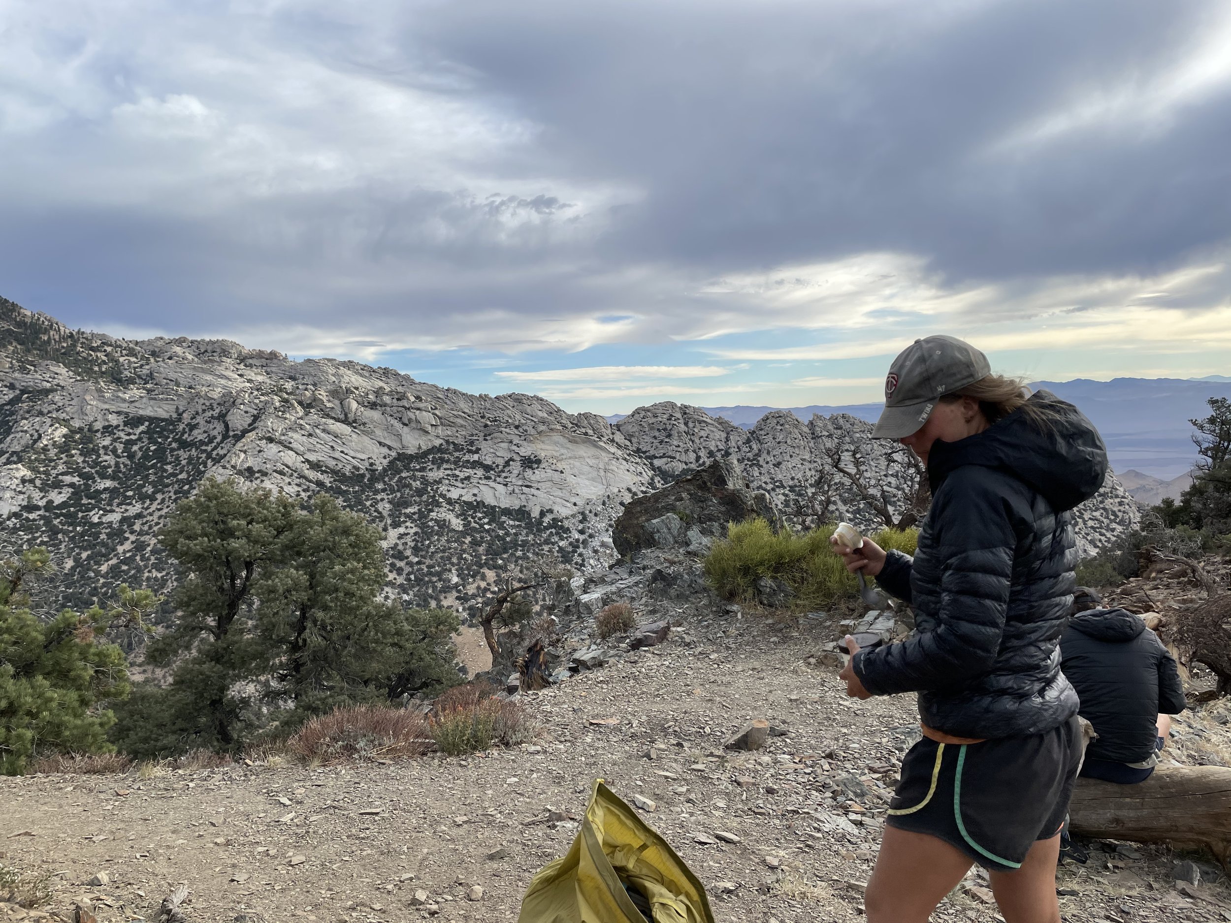
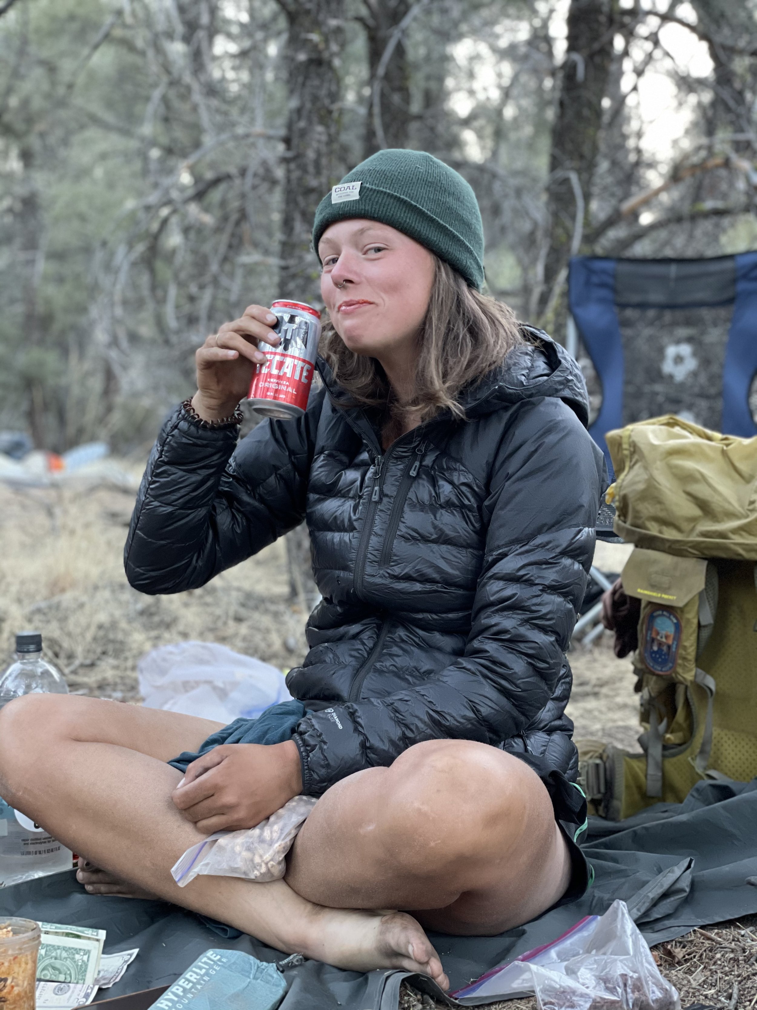
One of my favorite moments of the Desert section happened this afternoon. We were drinking room temperature (105 degree) Tecates with lunch. Fireball asked to borrow Captain Fantastic’s hot sauce, flooded the brim of her beer can with it, took a tongueful of hot sauce off the can, and then chased it with a sip of beer. We all looked at her as if she had turned invisible and she said to the group “what? you guys don’t do Tecate bombs?” I thought she was the coolest person in the world.
Traps and I pushed another beer fueled 5 miles out of Mikes place and camped with Taters, Hopscotch, and Lighthouse.
Day 8 Miles 131.5 - 151.8 20.3 Hiked
I was so tired this morning that Traps had to wake me up. We hustled out of camp and made it to a shitty water source with our friend, Spielberg. It was here that Traps gave me my trail name “Coach”. I like to tell people that they gave me the name because i started the trail with a bunch of Gatorade packets and was asking people if they wanted any. This was definitely part of it, but, in reality, the main factor was that, at the time, I was doing pushups in the morning before we got hiking and was a BIG fan of taking ice baths whenever the opportunity came up.
Traps and I pushed through a very hot, dry day stopping only to call our Moms for mother’s day. We made it down to a road where, having failed to hitch, walked a mile to Paradise Valley Café. The Café had been closed for well over an hour so we were just excited to get some water and camp behind the restaurant. As we walked up, the owner of the restaurant was tending to his flower pots. He asked us if we would like a sandwich and a beer. It was the best turn of events on trail to this point. we were stoked.

Day 9 Miles 151.8 - 151.8 ZERO Hiked
The first Zero day of the trail. A zero is when you hike no miles for the day. a Nero is when you do nearly zero. you’ll hear me refer to “neroing in” or “neroing out of” town a lot going forward. We got a ride into town, checked into our little hotel cabin, and set to work exploring the town and getting our resupply done. Traps and I both mailed home a few pieces of gear that we didn’t need and were lucky enough to meet the Mayor of Idyllwild! A dog named Max. I disagree vehemently with his fiscal pawlicies but he was nice enough.
We met up with a group of hikers for Pizza that night and then watched finding Dory in our little cabin. My feet were starting to Blister pretty badly and Traps’ shins were not doing too great. we were both happy to have the day off and rest up.
Day 10 Miles 151.8 - 168 16.2 Hiked
Traps found us a ride from a super nice guy and known trail angel, Detour, from the coffee shop and we got back on trail late morning. We were both hurting and struggled up a climb to join our Pizza restaurant crew for Lunch. Jeff, BABS, Pitch, Nightstalker, and Rock treated us to a bagel with cream cheese that they had packed out and we all pushed on towards Apache Spring to camp for the night.
By the end of the day Traps’ shins were killing them and I thought my Achilles were done for. we somehow made it to the spring and camp overlooking palm springs. Spirits got higher with a little Bourbon and a great view of Palm Springs coming to life as the sun went down. This was the first time I had serious thoughts about my ability to do this hike. The pain was real and we had another tough day of hiking tomorrow.

Traps and Coach near Apache Peak
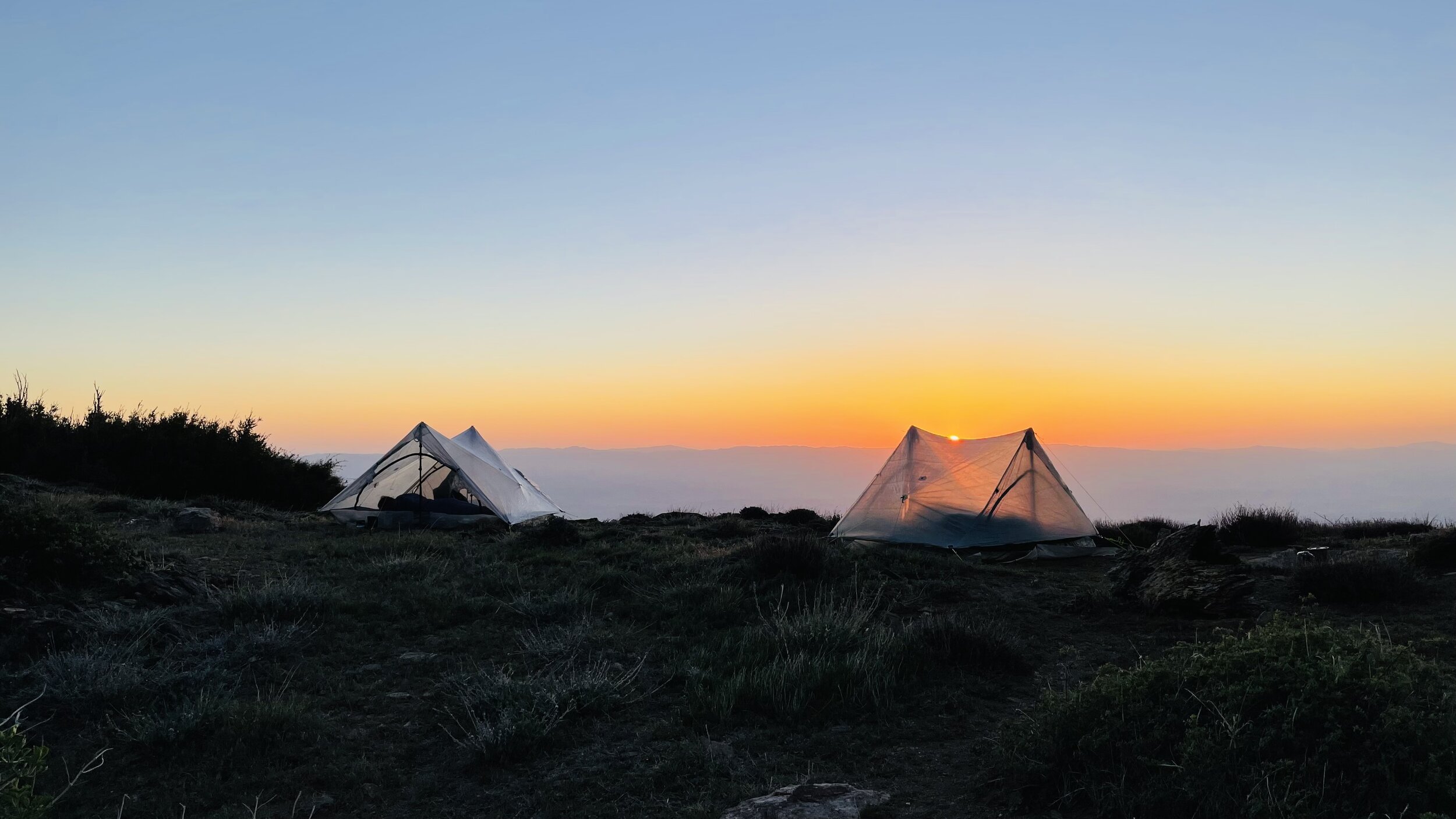
Photo courtesy of Jeff “Journey” Eldred

Day 11 Miles 168 - 186.2 18.2 Hiked
We had about a half mile straight back up from camp to rejoin the trail on the ridge the next morning. We passed Apache peak where Trevor “Microsoft” Laher tragically lost his life the year before us. we scrambled over some downed trees and around a rockslide as we progressed up towards San Jacinto.
Jeff, Rock, and Nightstalker pushed up to the summit of San Jacinto while Traps and I elected to skirt around the side of the mountain to get to camp a bit earlier since our injuries were hitting us. Pitch and BABS hung out to make some dinner before following the route that Traps and I took. looking down towards Idyllwild from the western side of San Jacinto was what felt like our first real mountain views and we were stoked to be taking it all in. we got an awesome spot on the western face of the mountain and were joined by the others just after dark.
Day 12 Miles 186.2 - 209.5 23.3 Hiked
Traps and I got rolling early the next day. we had about 7,000 feet of elevation to lose on our way back down to the dessert floor. This stretch is infamous for being incredibly exposed and having zero water. The morning did not start well as Traps fell hard and slid down part of the path while my knees decided that 1.5 miles was enough for them. We both medicated and pushed on.
We descended out of the alpine forest with its small patches of snow and quickly found ourselves back in the high desert that we were used to. We curved around the northern face of the mountain as Interstate 10 became visible on the floor in the distance. We passed the 200 mile marker and landed on the desert floor to find our friends Tigger and Fireball taking all the shade that they could find underneath a lone boulder next to a drinking fountain.
We pushed across the desert floor to the underpass where we found a cooler of ice cold beers and sodas. Traps and I made the call to join Tigger and Fireball in an uber into Desert Hot Springs. The 4 of us shared a hotel room where we showered, nursed our injuries, and crushed some pizzas while watching Mrs. Doubtfire. It was a nice night and certainly beat our default plan of sleeping under a highway.


Day 13 Miles 209.5 - 226.2 16.7 Hiked
Traps and I grabbed an uber back to the trail early and got moving. We navigated a few snakes on our way to an awesome Siesta spot along a small river. Jeff, Rock, and Nightstalker were already there along with Bartender and Strings. We joined them in an extended lunch break to avoid hiking in the hottest part of the day.
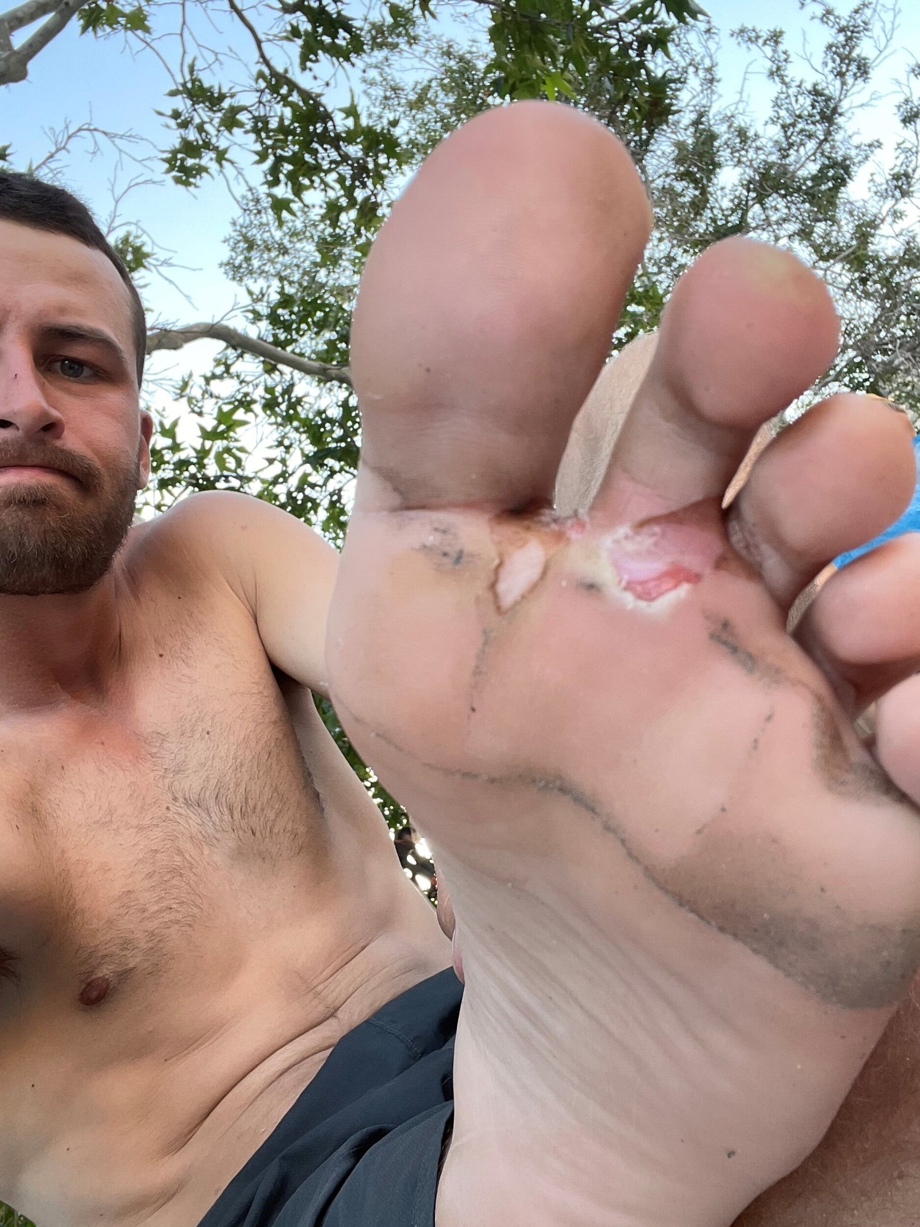
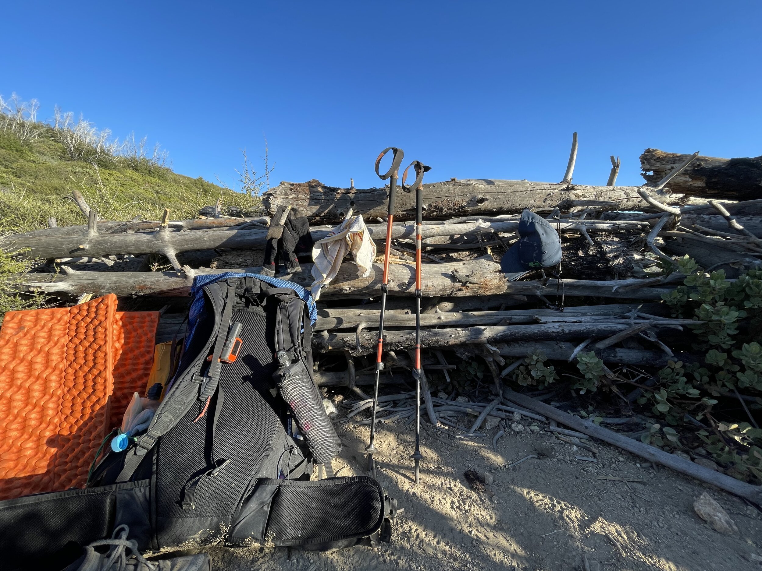
We got moving again around 4 and did another 6 miles into camp on the banks of a small stream. the blistering on my left foot had gotten a lot worse in the past few days and it was incredibly painful to hike on. I washed it out with creak water and then hit it with hand sanitizer to ensure it wouldn’t get infected. the picture below is what it looked like this night as we camped under a tree on the banks of the creek. It would get worse from here as my three middle toes separated from the pad of my foot.
Day 14 Miles 226.2 - 246.4 20.2 Hiked
We got hiking by 4:30 and caught up to Jeff, Nightstalker, and Rock pretty quick. we pushed a hilly 14 miles into lunch near some dirt roads. A group of equestrians rolled through and were shocked to hear that we had walked all the way there from Mexico. this was the first of many times that we would feel like rockstars telling people that, wherever we were, we had walked there. In reality, we are just accomplished pedestrians, but it always felt cool to have people be impressed. And this first instance was only about 9% into the hike…
We crushed another 6 miles out of Siesta and made it to an abandoned Cabin on some state land. Due to the mice (and ghosts) most of us elected to cowboy camp on the front porch where we settled in like sardines, only worse smelling, for a cold and clear night.

Photo courtesy of Jeff “Journey” Eldred
The only thing taller than Jeff out there…
Day 15 Miles 246.4 - 265 18.6 Hiked
We woke up to a cold morning on our front porch and took our time getting packed up. We were planning on taking it easy today since we only had about 19 miles to get to highway 18 (access to Big Bear city) where we had booked an Airbnb for the following night.
As the day progressed, we had some miscommunication on how far we were targeting and ended up going almost all the way to the highway. there was a bit of tension but all was quickly forgotten and we went to bed looking forward to an early ride into Big Bear the next morning.
Days 16-17 Double Zero in Big Bear
We got a ride into town from a trail angel who dropped us straight at a breakfast place. We got to work getting back some calories before grabbing a resupply at the grocery store where a stranger gave Rock $20 because he thought he was homeless. We then walked about a mile to the bnb that my mom had booked for us (thanks mom!) where we spent the rest of the day showering up, nursing injuries, and eating ice cream in the hot tub.
Traps flexed their barista / chef skills HARD the next morning by crafting some ridiculous breakfast sandwiches for everyone. The rest of the day was spent watching Marvel movies from the hot tub, hitting some gear stores, and grabbing barbeque for dinner. we all fell asleep watching Moana.
Jeff, who was previously an army ranger, probably saved my hike over this double zero by helping me clean out my shredded feet and sealing it all back up with second skin. Thanks Trail Dad


Day 18 Miles 265 - 285 20 Hiked
We got a quick breakfast and a ride back to highway 18 to rejoin the trail. It was a leisurely 10 miles into lunch where traps and I surprised everyone with mini bottles of red wine. This was not conducive to high caliber hiking and was probably an influence in Traps and I taking a wrong turn and ending up a mile off of the trail.
I climbed back up hard, mad at myself for making that mistake with such a heavy pack and hurting feet, and pushed the last 8 or so miles into camp. Jeff was already waiting for us. We all camped right by a creek through a windy night. We were all missing our Airbnb a bit.

Day 19 Miles 285 - 305 20 Hiked
We hiked 12 miles to deep creek for siesta where we met a new hiker, Gamechanger. Game was from West Texas and quickly became one of my favorite guys on trail. Jeff bushwhacked a few hundred yards off trail to an awesome siesta spot by a deep pool with some cliffs that we could jump from.
We got back on trail and pushed a few more miles past the 300 marker! Traps, Jeff, and I took some pictures and hiked on a few more miles to camp just shy of the Deep Creek Hot Springs.
The hot springs are known to attract a lot of day hikers so we went to bed early to ensure we would get there before the crowds.
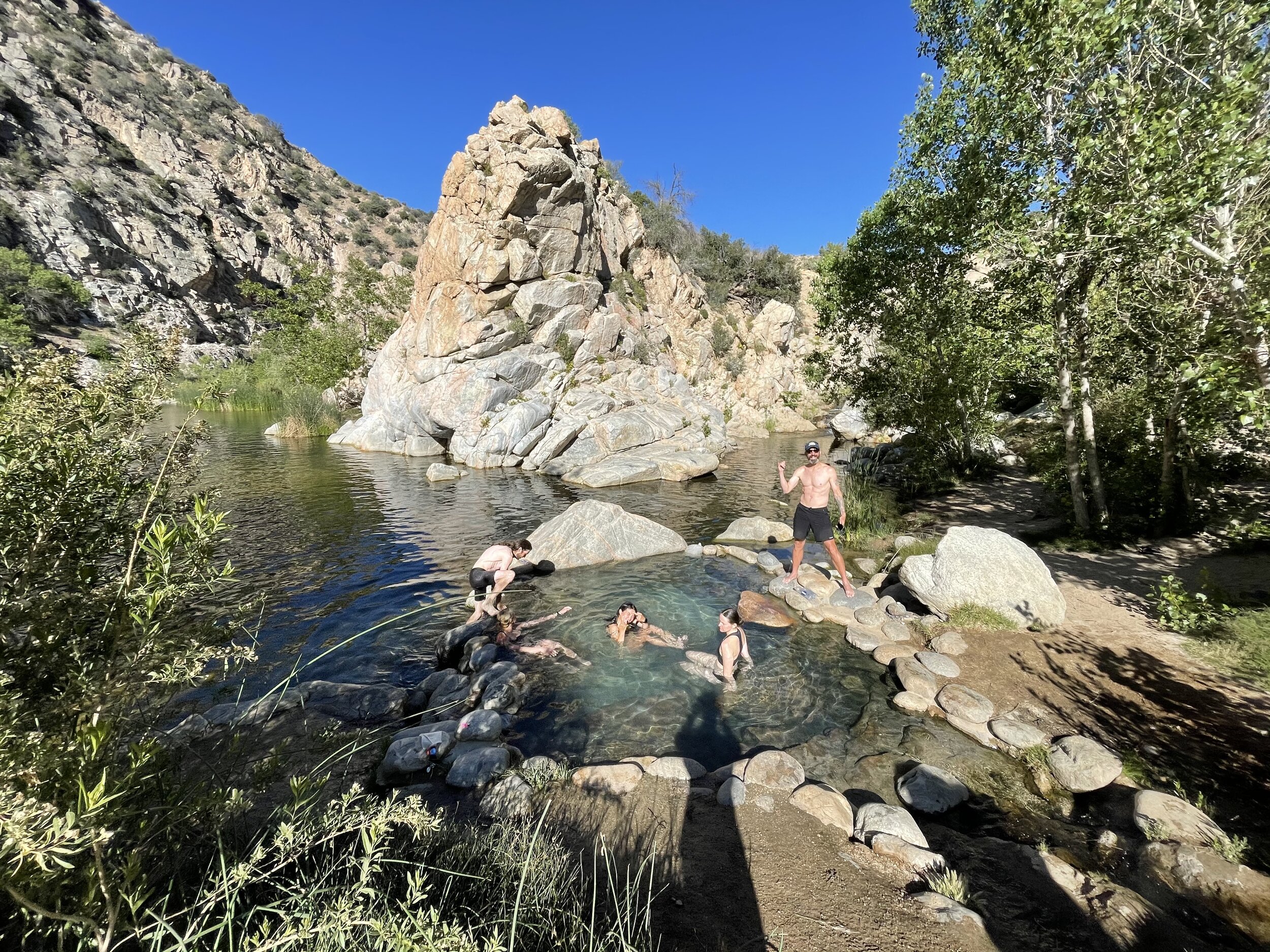
Day 20 Miles 305 - 329 24 Hiked
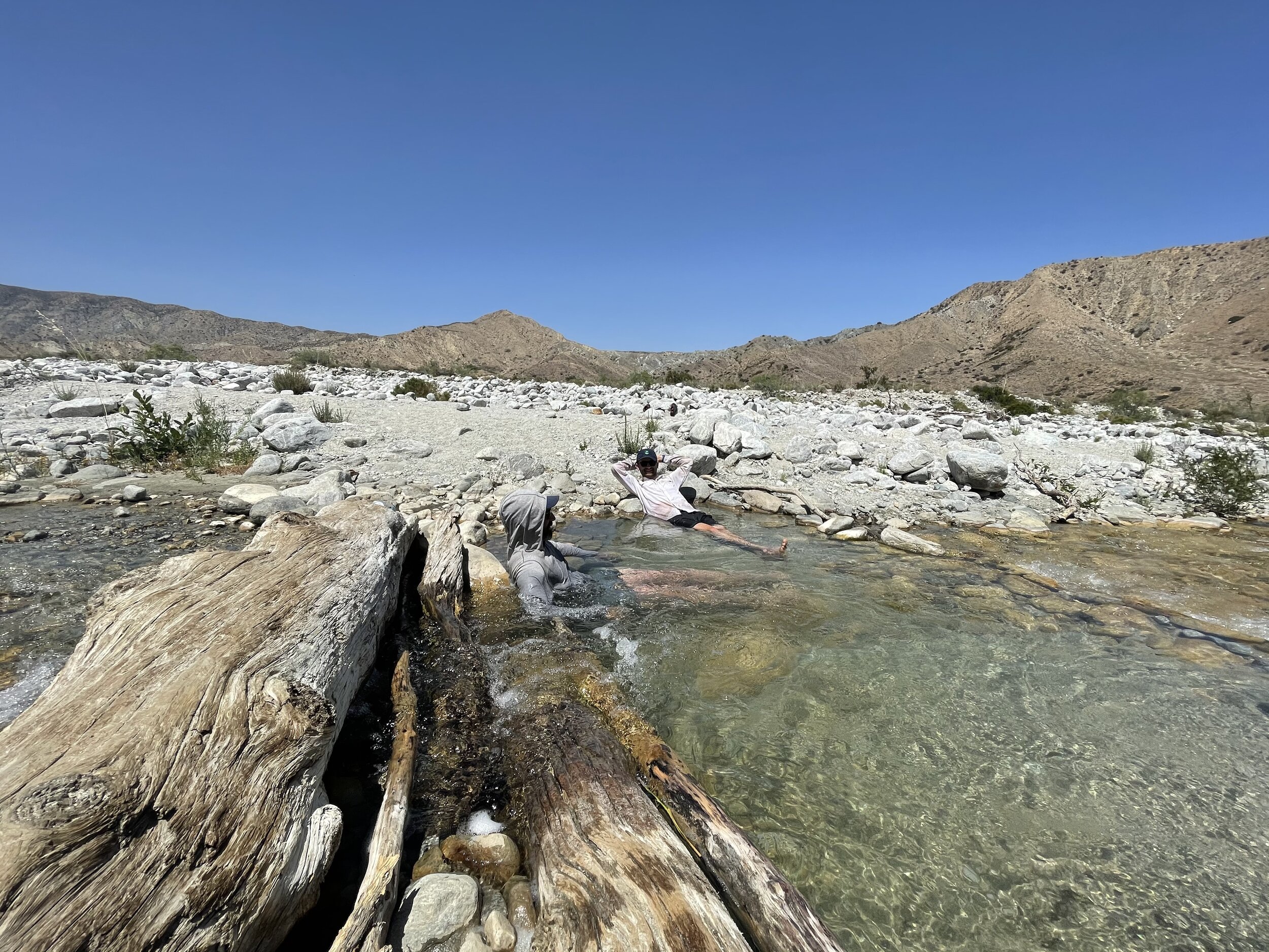
We got moving out of camp early and made it the 2 miles into the hot springs. Here we found Tigger and some other hikers who had camped near the springs the night before. Our group enjoyed the natural 100 degrees pools as well as the much cooler creek that they feed into. Some crowds started to roll in so we pushed on through the scenic ridges and onto siesta about 10 miles later.
We made the call to make it a longer day and push on to Silverwood lake, a front country campground a further 14 miles from Siesta. it started to rain a bit and everyone was exhausted and cold by the time we got to the campsite. We ordered some pizzas and beer which did little to improve morale. I was using Jeff’s tent stake to open beer bottles without telling him and so he spent a while looking around for it while trying to put up his tent. I felt pretty bad about it but a penance of some bourbon was enough to smooth things over. Sorry Jeff!
Day 21 Miles 329 - 347 18 Hiked
Breakfast of leftover pizza and Modelo fueled us the first 12 miles to Cajon Pass. This is where a major highway cuts across the PCT and the trail goes under it in a series of tunnels. The trail also conveniently crosses under less than a mile up the road from a McDonalds. Traps flew to get into line and called Tigger and I to get our orders which was an absolutely heroic move.
Dirty and tired, we enjoyed our lunch break in the shade of a tree next to the McDonalds and watched as more and more hikers rolled in to join us. Jeff, BABS and Nightstalker were itching to push on but the rest of us opted to do just a few miles further after we had finished our loitering. We camped at a water cache at mile 347, had a few beers that we had packed out, and played Uno until it was bedtime.
Day 22 Miles 347 - 364 17 Hiked
We had a 17 mile dry stretch today straight uphill to the ridge overlooking the town of Wrightwood. Rock’s phone had broken at the hot springs so he took one of my ear pods and we listened to the Fellowship of the Ring together for a good chunk of the day. Traps said that we looked hilarious hiking 5 feet apart all day.
We made it up to Guffy campground and met Tailgate and Trouble. two sisters from Colorado that I would see a few more times along the trail. They were always good company and it was nice to camp with some new faces. We had a campfire in a fire ring (the only one I would have for the whole trail) and roasted the bag of marshmallows that rock had packed out. The marshmallows had sort of melted together so we roasted them as one clump on the end of a big stick and passed it around to take bites out of it. It looked like we were cavepeople passing around a leg of Mutton or something. it was very funny

Pitch, Gary, Rock, Strings, and Traps
Day 23 Miles 364 - 369 5 Hiked
We only had about 5 miles today down some ski slopes to get to the road leading into the town of Wrightwood. The previous day, I had met some day hikers out with their dogs who kindly offered to give us a ride into town when they heard what we were doing. Gary picked our whole group up and dropped us at his favorite breakfast place. He wouldn’t take a dime from us and we would stay in touch over text until the end of the hike.
We had connected with a local trail angel, Jeff, who let hikers stay at his house in town FOR FREE. He picked us up in his truck and we did some laundry at his house after resupplying at the grocery store. We of course earned our keep by helping out around the house and left a donation on his counter. Still, the kindness that he showed us was unbelievable.
Wrightwood has a reputation of being a friendly place but we were blown away. It is very difficult to communicate just how welcoming and pure this place felt.
Day 24 Miles 369 - 390 21 Hiked
We got a hitch out of town early in the morning and got back on trail. We had 5 quick miles to get to the base of Mt Baden-Powell. the climb up was steep but well graded and we summited for a lunch break. This was the highest i had ever been and the silence and stillness was very cool to experience.
We pushed on down the mountain and filled up on water at Little Jimmy spring. from here we had our first real burn zone. It was very eerie to walk through this alone. Fire closures further up the trail would mean that we would join the road at Islip saddle and walk on the closed highway 2 for about 30 miles before rejoining the PCT at 3 points.
We made it down to the highway and walked about 6 miles to a campground that was completely empty since the road was closed. we rolled in after dark so we just put out our tarps and slept like sardines under the stars. all 5 of us on one tent pad.


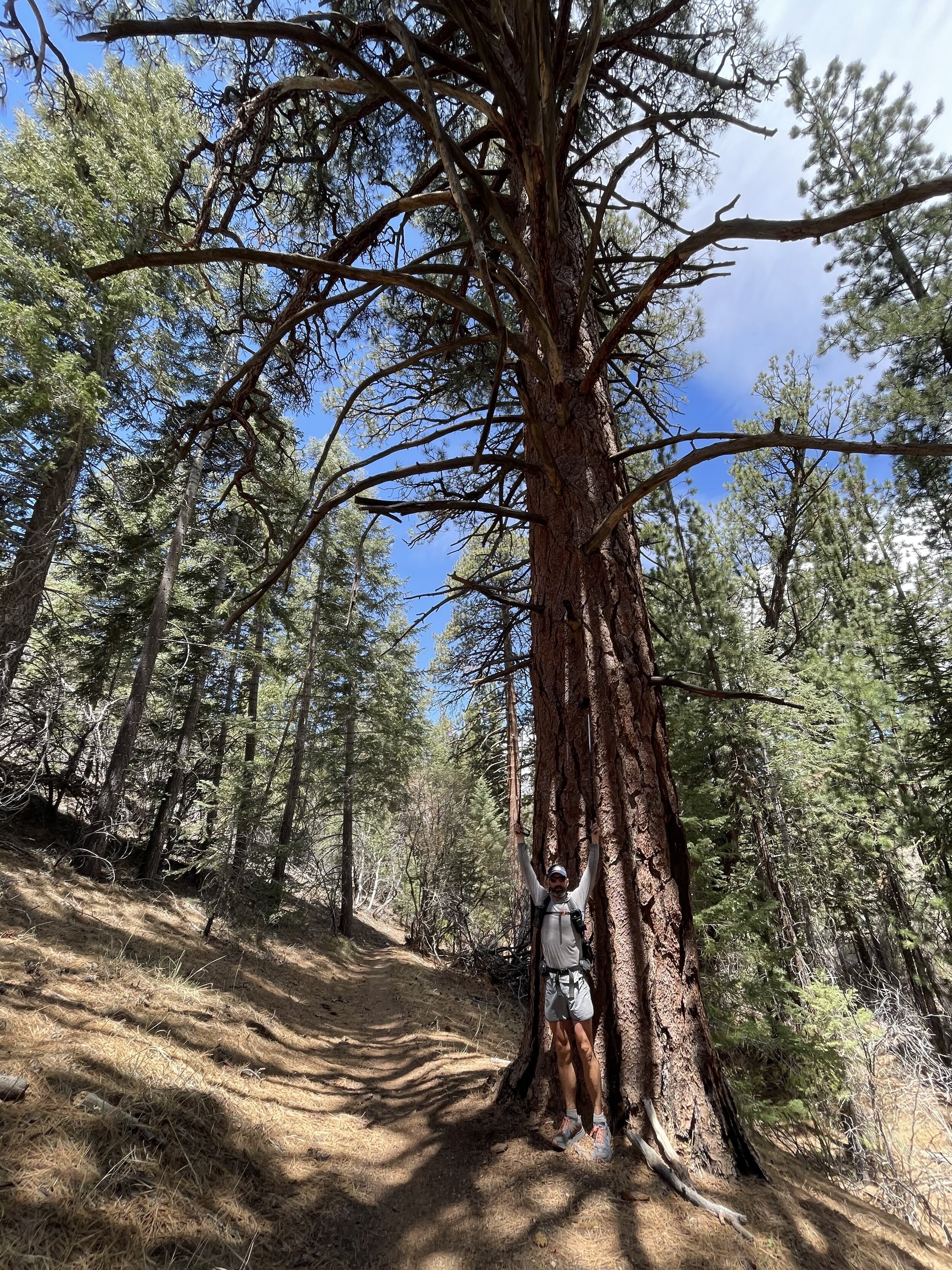
Some ancient trees near the summit of Baden-Powell
Day 25 Miles 390 - 424 27 Hiked*
We took our sweet time rolling out of camp since we had access to a picnic table and pit toilets. We had another 7 miles of road walking to get back to the trail and an early siesta. I made the decision to split away from he group here since I needed to finish the desert by June 10th to get picked up to go stand in my friends wedding. I would meet back up with this group at BABS’ house in Agua Dulce where we were planning on taking a zero in two days time.
I pushed another 12 miles by myself and found a spot to cowboy camp up on a ridge. this was my first night camping alone on the trail which always made me feel a bit scared. The moon was the brightest I had ever seen but I managed to sleep for a few hours knowing that tomorrow I would have a big day.
This would also be the first night where I had camped without my good friend Traps. I made a note about how I didn’t think I would have made it this far if not for their help these first few weeks. I felt very lucky to have had such great people around me for the start of this trek.
less miles due to road walk alternate around fire closure
Day 26 Miles 424 - 456 32 Hiked
My alarm got me up at 4:30 and I was hiking by 5. I had some frustrating miles through a severely overgrown section to make it to a water source. From there I pushed on to a backcountry fire station which had a cooler full of Gatorades and snacks which Tailgate and Trouble were hanging out at. I had 8 hot and exposed miles from there down to the Acton KOA campground where I found some of my friends at the pool. I spent a good two hours here for lunch and rehydration before heading back out.
Out of the campground I had some more hot, dry miles with no other hikers anywhere in sight. I passed through Vazquez rocks and was stopped by a photographer who was out there taking PCT thru hiker pictures for a project. We had a nice chat and he got this picture of me.
From there it was just 2.5 miles of road walking through downtown Agua Dulce before getting to BABS’ house on the north side of town. Her mom and step dad were incredibly welcoming and it felt good to have a full dinner and shower after my 32.5 mile day. Thanks Jida and Diablo!

Day 27 - Full Zero at BABS’ house
We had a lazy morning as we waited for the rest of the group to roll in. We made a run to REI where I got some new shoes. My feet had grown from size 11.5 to 13 and my new Hoka Speedgoats looked ridiculous on my feet.
I weighed myself here for the first time on the trail and saw that I had dropped from 191 pounds to 165. a loss of 26 pounds in 26 days of hiking… I made sure to bulk up my resupply for this stretch and got as much high fat food into me as possible while still in town.
Jeff and I made plans to push on the next morning with kale and Fireball while the rest of the group would stay behind for another day or so to keep resting up
Day 28 - Miles 456 - 478 22 Hiked
We had some pancakes and coffee in the morning before BABS dropped us off at the trail. It was already getting hot and we had a rough 10 miles to our lunch spot by a water cache.
We had some more climbing from there but made it to a road with a fire station where we could camp. I could tell that Jeff’s shoes had not worked for him since his Hoka Speedgoat tracks changed to those of his sandals. He was several miles ahead of me but i knew he must be hurting to switch up his shoes this early.
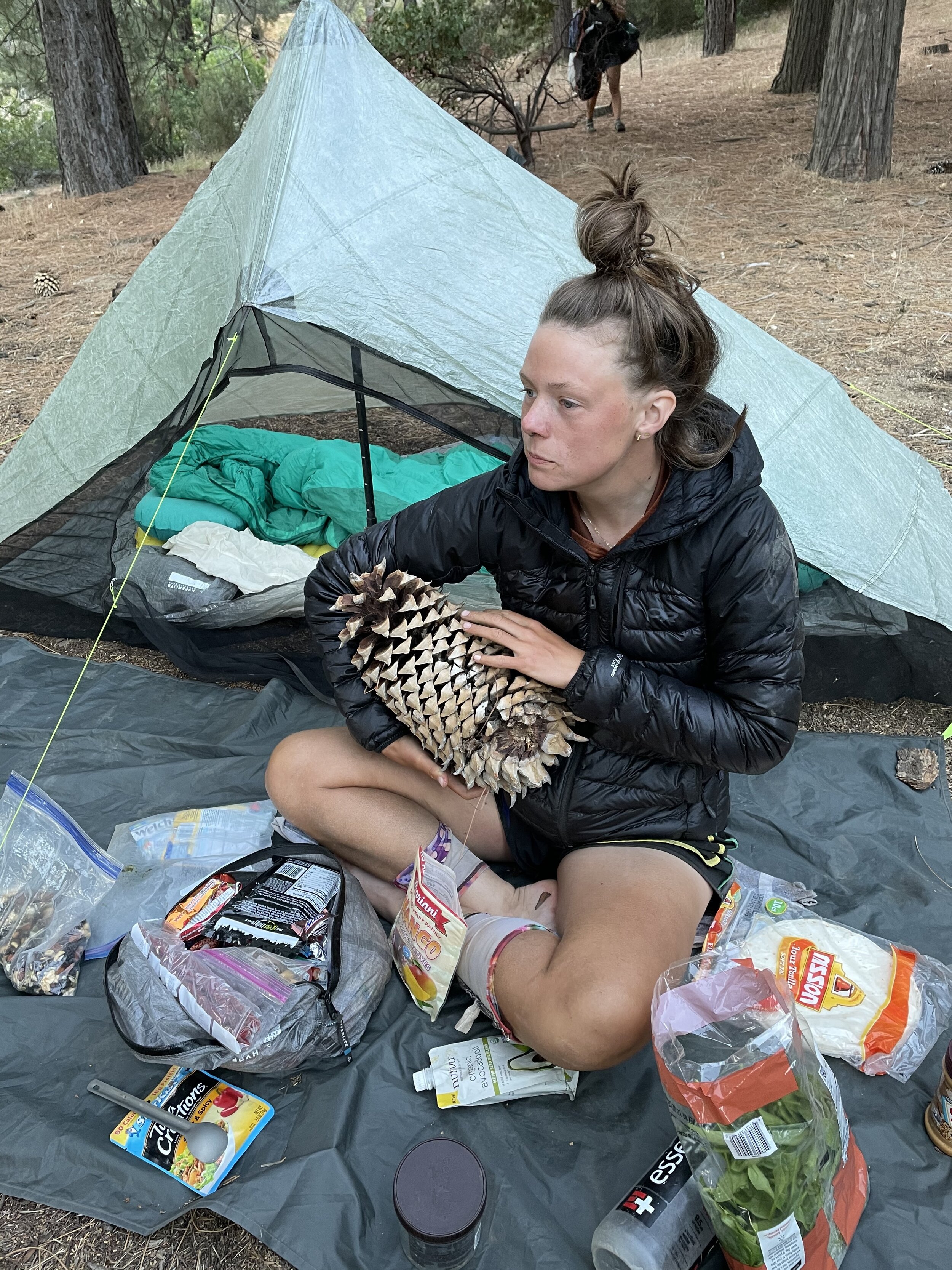
We descended down to a little road with the fire station and camped amongst the biggest pinecones I had ever seen.
Day 29 - Miles 478 - 517 25ish Hiked*
We had a small climb the next morning to find where Tigger, Balue and Game had camped up on a ridge. We pushed a quick 6 or so miles down to a road where we would have to part with the trail for a short stretch due to a fire that had burned here in previous years.
We road walked to a little inn where we got some breakfast and prepped for the half marathon of exposed pavement walking we were about to hit. We were incredibly lucky that it was a Saturday and lots of trail magic was being offered by motorists passing by. We stopped only to buy a can of Dr. Pepper at a local ostrich farm and pushed on to where the road rejoined the trail.
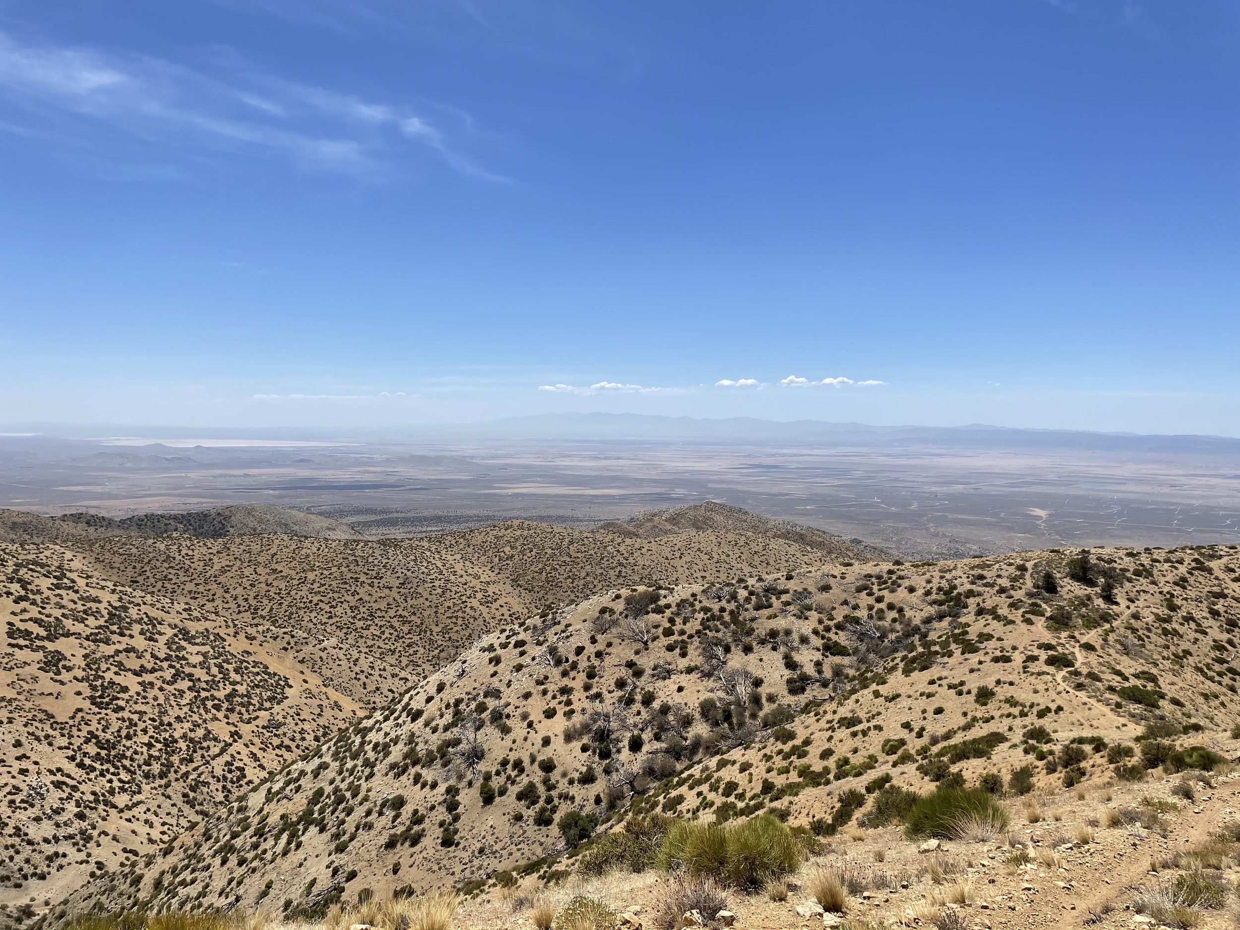
From there it was a nice 6 miles and change through the desert mountains and onto a ridge where we got our first look at the flat expanse of the Mojave desert below. I was solo at this point and descended down onto the plains to Hikertown. Hikertown is a collection of themed sheds on someone’s property where hikers typically wait out the heat before hiking the ultra exposed and dry LA aqueduct section of the trail. our plan was to wait out the heat here the next day and start hiking the aqueduct the following night.

Day 30 - Miles 517 - 534 17 Hiked
Fireball and I had split a shed for the night. When I say shed, I mean shed. No electricity, no windows, and the beds were little ottoman things with sheets over them. It was barely worth the $10 to stay out of the desert winds that had whipped all night.
The day was spent bumming around Hiker town, trying to stay in the shade and rest up for what would be a long night. Another Instagram friend of mine, Fred (Sundae) rolled in with some of her group and they joined us in our loitering.
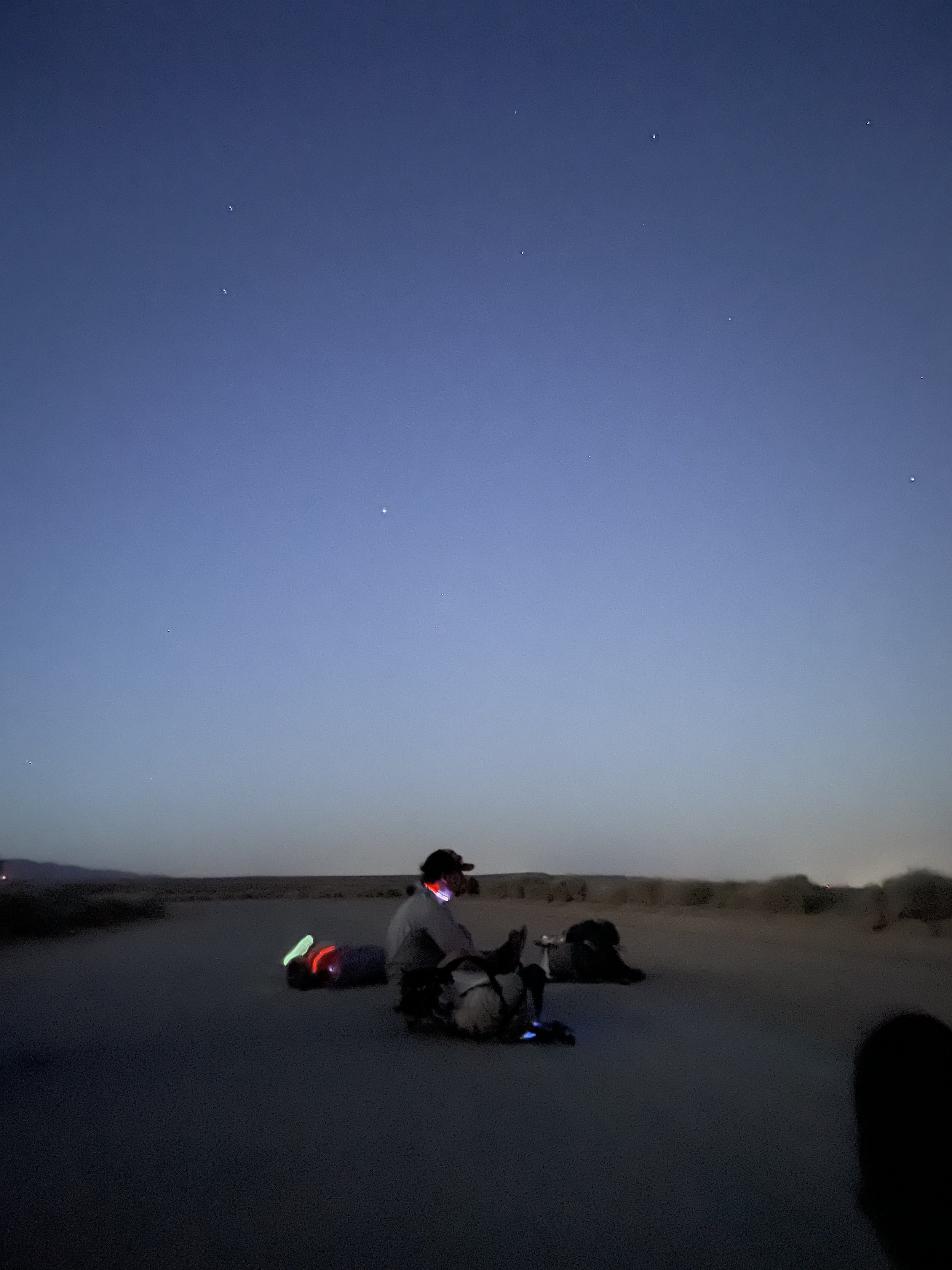
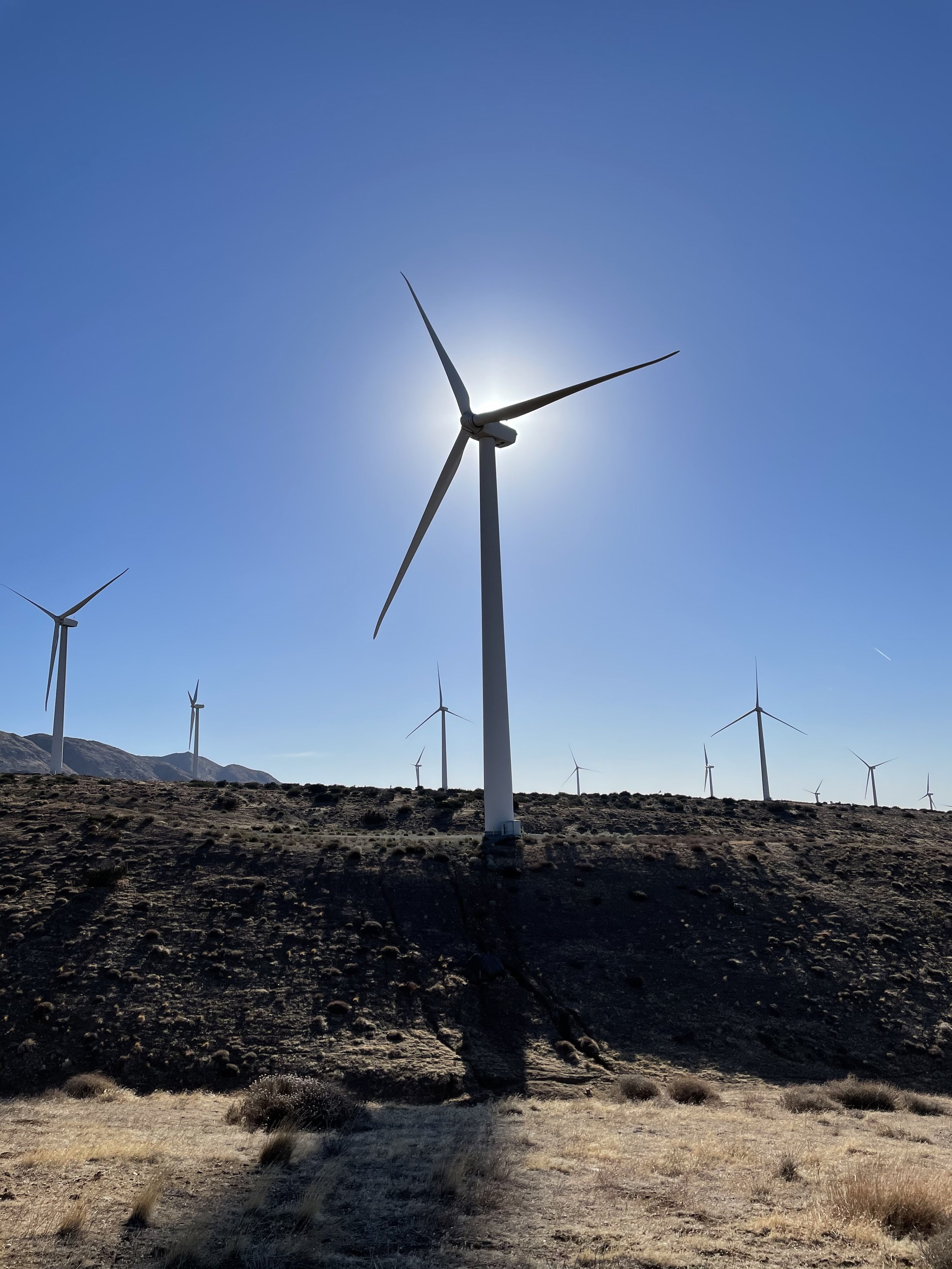
We started hiking at 6:30 pm. it was still over 100 degrees out but had to get moving to ensure we made it to the next water. We hiked alongside the massive LA aqueduct pipe as the sun set to the west. There was enough starlight to keep our headlamps in our packs as we pushed on past midnight. Eventually, we made it to the water cache in a massive wind farm and found a spot to cowboy camp for a few hours shortly after.
This was one of the most surreal experiences of the trail. So different than anything i had ever experienced before in my life. Hiking through the desert with no lights, while the wind rages all around us, and the only visible landmarks the array of thousands of blinking red signal lights on top of the windmills ahead.
Day 31 - Miles 534 - 558 24 Hiked
I woke up to see everyone around me moving fast to pack up their stuff. It was 5 am and already getting very hot. We pushed a hard 8 miles to get to a creek to re-up on water and then another 8 to a siesta spot up on a ridge. This was probably the hottest hiking of the entire trip for me. Well over 100 degrees out.
I fell asleep immediately at the siesta spot and woke up after a few hours to push on solo another 8 through a wind farm and down to the road leading into Tehachapi.
Jeff was meeting his brother and dad at Mojave so we would only have a few miles the following day up to another road where we would get picked up for a nero into town.

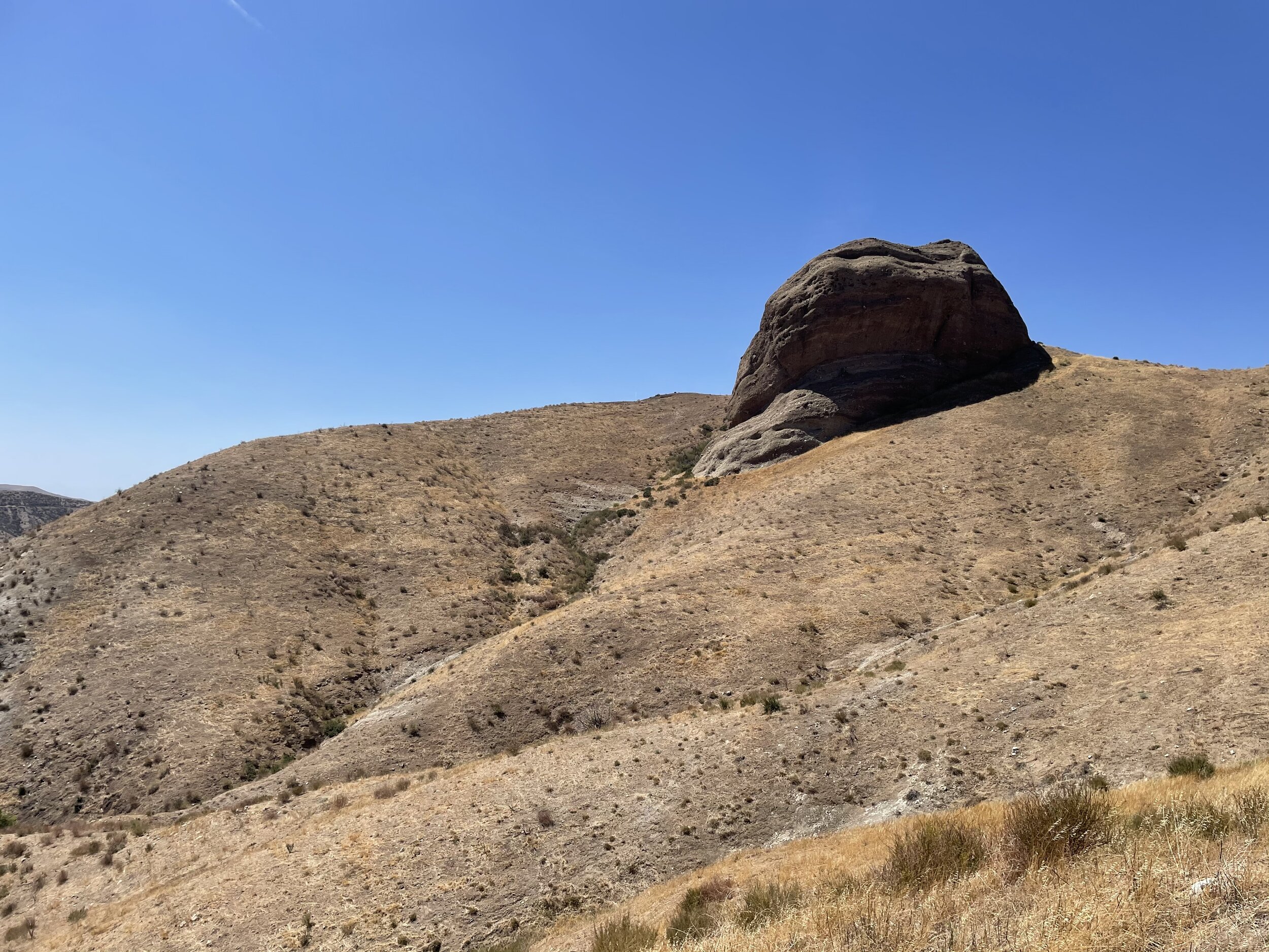
The Mojave desert below us
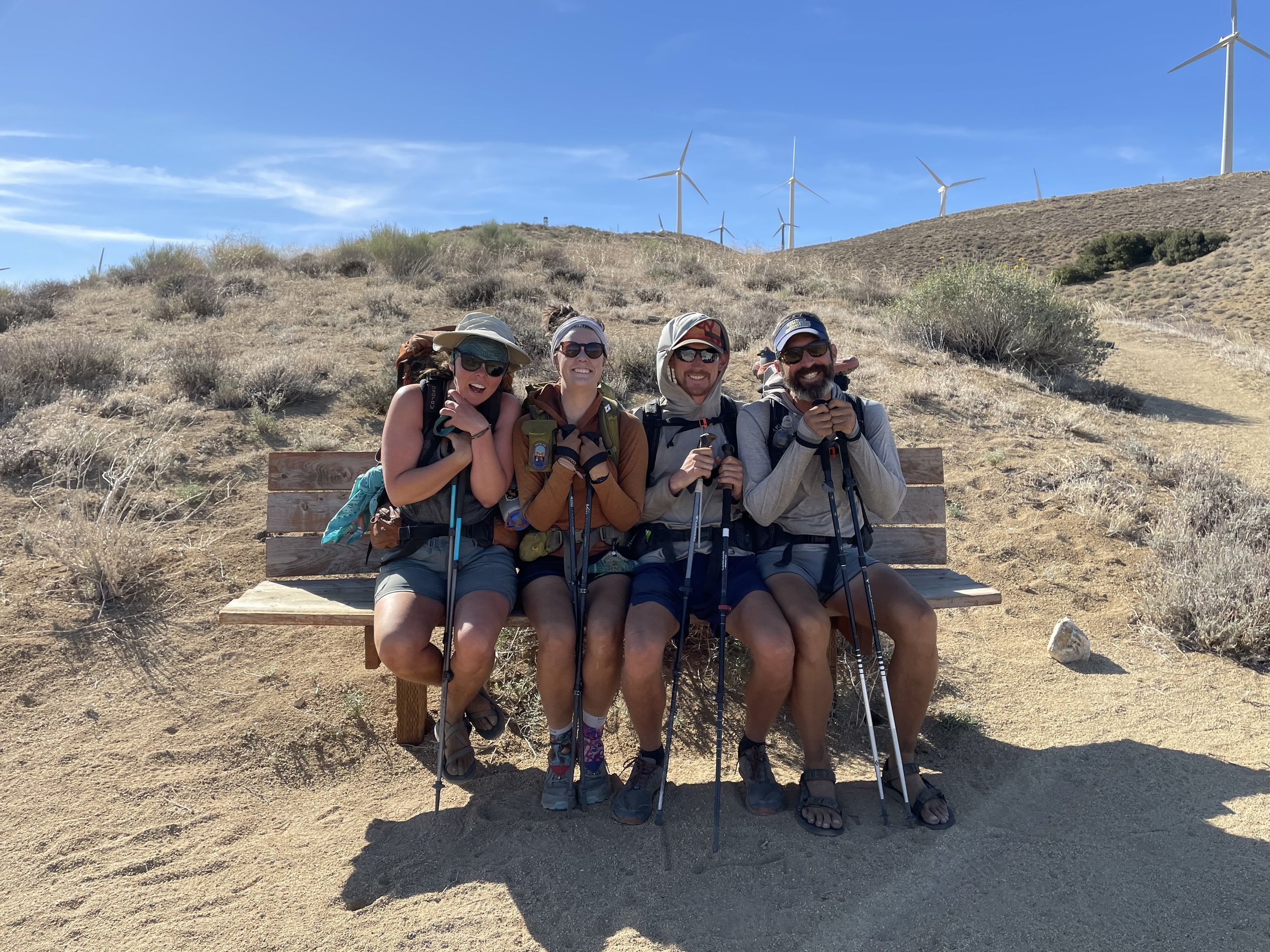
Kale, Fireball, Tigger and Journey
Day 32 - Miles 558 - 566 8 Hiked
We woke up from our little cowboy camp spot and were excited to push a quick 8 miles before it got too hot. Our merry little party walked through the windfarms and down to our first major highway crossing in a long time.
We waited under the shade of a tree for Jeff’s dad and brother (Jim and David) to pick us up in their rental car. We hit a deli for some quick sandwiches before resupplying and grabbing showers at the motel we were staying at. We got dinner and went o bed early since we were targeting a 4 am start the next day.
To any future hikers, go to Tehachapi and not Mojave. It was my least favorite town of the whole trail. very little options for food or resupply. You are much better off hitching into Tehachapi from the first road crossing.
Day 33 - Miles 566 - 587 21 Hiked
Our alarms rang in unison at 3:30 am. We packed our stuff quickly and filled up on water before Jim picked us up. He dropped us off right where we had been picked up and we started out with our headlamps on to cross over the highway and start the massive climb up. Our packs were stocked with a full resupply and as much water as we could carry.
Jeff’s brother, David, would be joining us for this stretch of trail and it was nice to have another companion in our group. David is very experienced in the outdoors and he was able to keep up no problem. It was very impressive.
The sun rose as we made our way up and I surprisingly felt fairly strong. I listened to Olivia Rodrigo’s album for the first time and pushed up above the desert floor to the cooler high desert forest where we found a siesta spot by a spring.
After siesta, the group of us pushed a casual 4 miles to cowboy camp in a little grove. Ants attacked us all night. Jeff put up his tent at 3 am while the rest of us swatted at the bugs until it was time to get up.

Day 34 - Miles 587 - 609 22 Hiked
We woke up at 4 and were hiking by headlamp by 4:30. it felt good to get most of our miles done before the heat and hang out at a concrete cistern which was fed by a spring for our mid day break.
We passed the 600 mile mark and made it to Landers camp which was an awesome spot. It was reachable by dirt road so there were a few folks around but there was an incredible spring where we could do a little laundry and settle in for the night. We were joined here by Retro, a woman hiking with paper maps and a Motorola Razr, as well as Abby’s Person, an older man thru hiking with his dog named Abby.
Day 35 - Miles 609 - 635 26 Hiked
We were hiking before the sun was up and were again treated to an incredible sunrise. Jeff’s dad met us at a dirt road crossing about 8 miles in for some coffee and donuts which was a real treat. People on trail got Jeff and I mixed up sometimes which is not good news for me since Jeff was 49 and I was 26… He has a kid my age. Anyway, I got a picture with my trail dad and his dad. 3 generations of hikers.
We pushed on through a super exposed section as it started to get warmer and made it down to a water cache at Bird Spring pass. It was incredibly hot, windy, and exposed so we all retreated to little pockets of shade under some bushes where we tried to get some rest.
We left our little dens at about 5:30 to hike to the top of Skinner Peak. I felt strong and made it to the top in time to catch the sunset with Tigger while the rest of the group filtered in over the next hour. We had some nice cowboy spots around another group and settled in for the night.


Day 36 - Miles 635 - 656 21 Hiked
We caught the sunrise from the top of Skinner peak and pushed on hard to try and make it to Walker Pass campground for siesta. Walker Pass is where the trail crosses the road into Lake Isabella and we were hoping for some trail magic from Jeff’s dad who would be picking up his two sons from the campground that day.
We said our farewells to Jeff (for now), Jim, and David and got some additional trial magic from other hikers that had arrived. It was here that we met some new hikers including “Trail Goblin” who I had been following on Instagram since before the hike had started! We pushed from Walker Pass up another peak across the highway and camped with some newer folks.
Kale had pushed on a bit further so it was just me, Tigger, and Fireball for the night. We were joined by Smokey and Paul and settled in for a cool sleep under the stars.
Day 37 - Miles 656 - 681 25 Hiked
We had a fun first few miles out of Camp since we had gotten some rare reception and had a great view down to the valley floor. Tig, Fireball, and I stopped often to take in the views and have some breakfast.
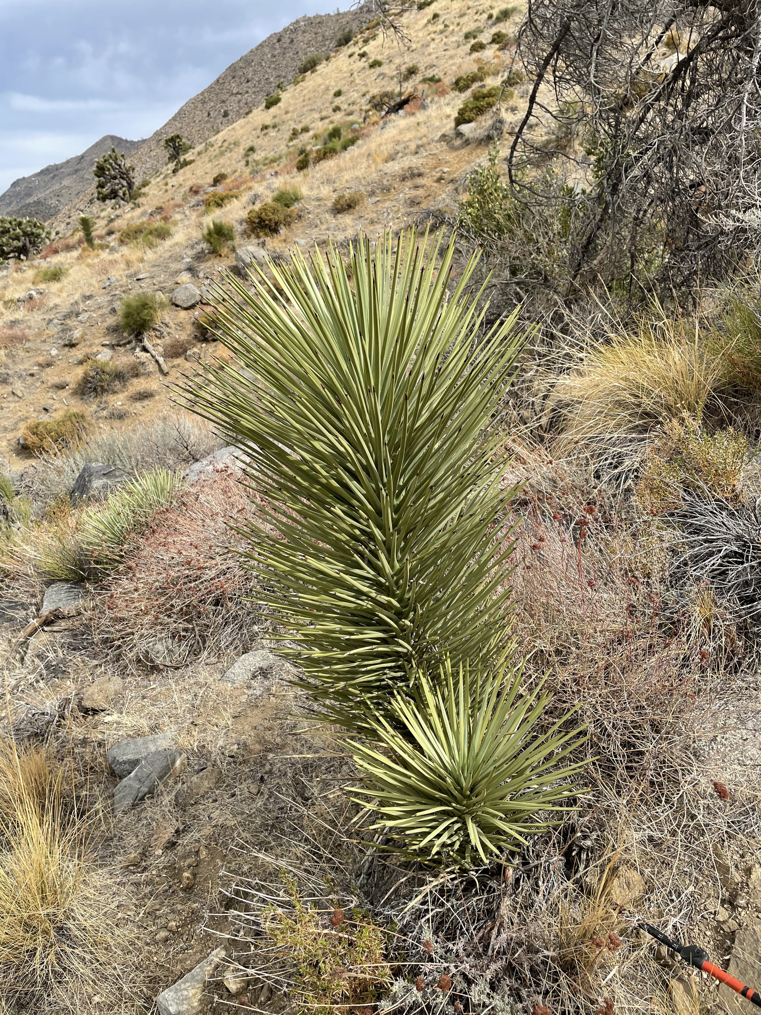
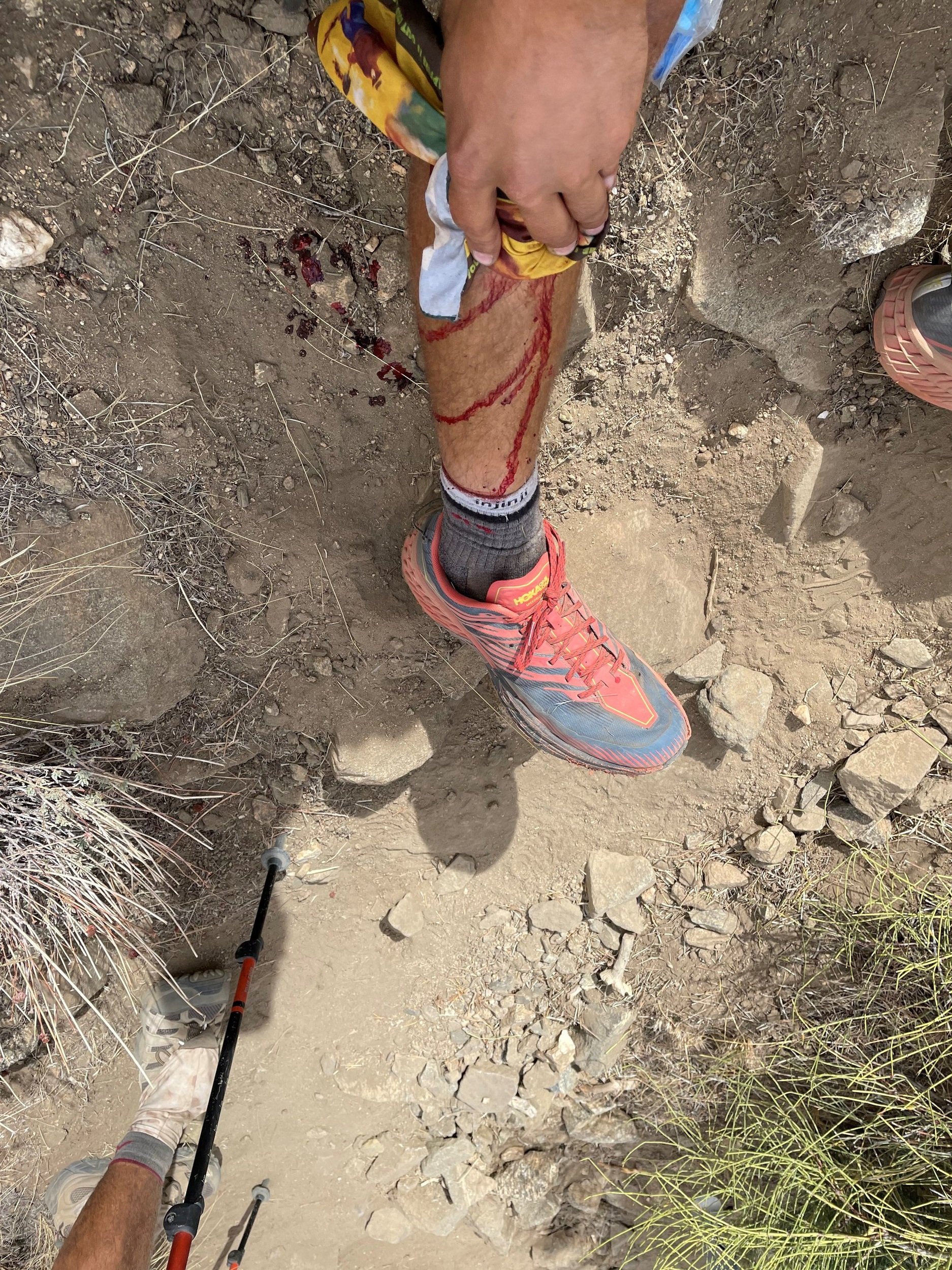
We pushed on down a hill and back into some of the desert plains. While hiking with Smokey, Safari, and Tigger, I lost my focus and walked straight into a baby Joshua tree. I stepped back, said some words, and watched as blood started to flow from the two puncture wounds. Smokey helped me stop the bleeding with his bandana. I hit the wounds with an alcohol wipe and taped it up.
I was frustrated at myself for making such a stupid mistake so close to the end of the desert. I was also scared. The thought went through my head that I could be in some trouble when I saw how much blood there was. luckily, the bleeding stopped quickly and I felt fine for the rest of the day.
We siestad by a tiny trickle of a creek and had some hard climbing out of there up and around a bowl to camp at a site that was accessible by dirt road and had a nice man giving out some beers and trail magic. We were joined by Trail Goblin and Safari for a bit before they pushed on while we opted to camp there with our new friend, Teva.

From Left to Right: Coach, Tigger, Kale, Smokey, Fireball, and Dibs
Day 38 - Miles 681 - 702 21 Hiked
Last day of the desert. We were hiking by 5 in an attempt to get to Kennedy Meadows as quickly as possible. My friend Allison was picking me up tonight to get me back to LA so that we could fly to Virginia for a wedding the next day.
We stopped at the Kern river for a quick lunch break and dip. This was the first real running water we had seen in a long long time. We pushed on past the 700 mile marker and into the town of Kennedy Meadows. Other hikers applauded us as we rolled into the general store. We had finished the desert
Our group hung out at Grumpys (the local bar / hiker hangout) until Allison got there around 5 to pick me up. I said my farewells to this group hoping that I would see them again down the trail and headed for LA to start a quintuple zero.
It was a lot of fun to watch Allison interact with these new friends. I had known them for less than a month and felt like I knew them as well as my college friends. It was sad to say goodbye to them unsure if I would see them again.
Lakeside casual. Was fairly pleased with how normal i looked after a month on trail
Taking a vacation from my vacation
Days 39-44 - 5 Zeroes for Sean and Caroline’s wedding
This next bit is about my 5 days off trail so if you don’t care about me as a person feel free to skip up to the next section below!
I had called Allison a few weeks before I announced my hike to ask if she could help me out with getting off trail for a wedding. My good friend Sean was renewing his vows as he and Caroline had gotten married with a small ceremony the year before. Now that we were vaccinated, they had planned a renewal at Caroline’s lake house in Virginia where more of their friends and family could celebrate with them. Sean had asked me to be a groomsman and I wouldn’t have missed it for the world.
I fell asleep in the car fairly quickly and Allison woke me up when we got to her apartment in Santa Monica. I got a shower and a pint of ice cream while we caught up and Allison did some light surgery on my leg to make sure that nothing was stuck inside from my Joshua tree incident the previous day.
We had a full day in Santa Monica the next day before taking a red eye to Virginia. My parents had driven out from Wisconsin to see me and get me my Sierra gear. It was great spending some time with them on the drive. I am very close with my family and had missed them a lot.
It was incredibly motivating to talk to my friends about the experience so far and “joke” about how none of us thought I would have made it this far along. Sean’s dad, Jeff, was a big fan of the PCT even before I was hiking and we speculated on future adventures we should take on together. The ceremony was beautiful and I was glad to spend some time with Sean, Caroline, and the rest of our friends. We had a later night than was responsible and Allison and I got on a plane back to LA the following morning.


Next section, The Sierra